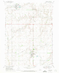
1969 Map of Harvard
USGS Topo · Published 1971About this map
Clay Center and Harvard anchor this landscape during a period of agricultural stability and military transition in central Nebraska. The western edge of the map is dominated by the sprawling footprint of the U S Naval Ammunition Depot (Abandoned), a massive facility that shaped the local economy through the mid-20th century. The terrain is defined by the drainage patterns of School Creek and Little Sandy Creek, with the Burlington Northern railroad providing the primary transit corridor through the northern plains.
Find a feature on this map
17 named features on this map. Tap any name to fly to it.
Don’t see what you’re looking for? This feature index may not catch every label — zoom into the map to look around manually.
Map Details
Editions of this 1969 Harvard Map
This is the sole edition of this map. No revisions or reprints were ever made.
Other maps of this area

1898 · York
USGS Topo · 1:125,000

1898 · Superior
USGS Topo · 1:125,000

1898 · Hebron
USGS Topo · 1:125,000

1898 · Grand Island
USGS Topo · 1:125,000

1899 · York
USGS Topo · 1:125,000

1955 · Lincoln
USGS Topo · 1:250,000

1955 · Grand Island
USGS Topo · 1:250,000

1957 · Lincoln
USGS Topo · 1:250,000

1957 · Grand Island
USGS Topo · 1:250,000

1958 · Grand Island
USGS Topo · 1:250,000