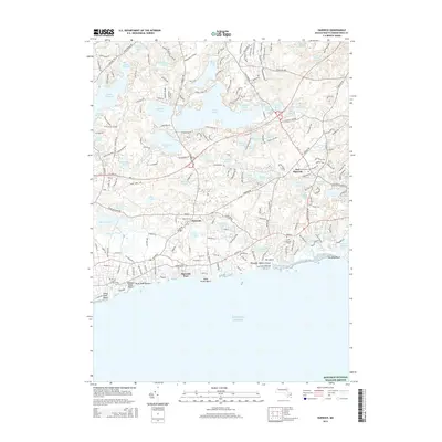
2015 Map of Harwich
USGS Topo · Published 2015About this map
Harwich Port and the village of Harwich anchor this coastal landscape where the freshwater network of the interior meets the Atlantic shoreline. The area is defined by its glacial kettle ponds, most notably the expansive Long Pond, Hinckleys Pond, and Seymour Pond, which feed into the Herring River drainage. Along the coast, a sequence of public access points including Bank Street Beach and Earle Road Beach demonstrates the modern development of the shoreline for recreation. The map provides significant detail for local historians, marking the locations of Evergreen Cem and South Chatham Cem. To the south, the boundary of the Monomoy National Wildlife Refuge reaches into the open water, while named features like Ebenezer Weekes Island and Oak Island denote small landforms within the coastal marshes and tidal zones.
Find a feature on this map
205 named features on this map. Tap any name to fly to it.
Don’t see what you’re looking for? This feature index may not catch every label — zoom into the map to look around manually.
Map Details
Editions of this 2015 Harwich Map
This is the sole edition of this map. No revisions or reprints were ever made.
Other maps of this area

1887 · Wellfleet
USGS Topo · 1:62,500

1887 · Yarmouth
USGS Topo · 1:62,500

1888 · Chatham
USGS Topo · 1:62,500

1889 · Yarmouth
USGS Topo · 1:62,500

1889 · Wellfleet
USGS Topo · 1:62,500

1893 · Chatham
USGS Topo · 1:62,500

1893 · Yarmouth
USGS Topo · 1:62,500

1893 · Wellfleet
USGS Topo · 1:62,500

1917 · Chatham
USGS Topo · 1:62,500

1942 · Cape Cod Bay
USGS Topo · 1:125,000