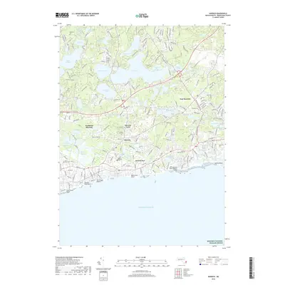
2018 Map of Harwich
USGS Topo · Published 2018About this map
Harwich Port and Harwich Center anchor this detailed study of the south shore of Cape Cod. The landscape is defined by its complex hydrography, where numerous freshwater bodies like Long Pond and Seymour Pond transition into the salt marshes and estuaries of the Herring River Marshes and Andrews River. The map captures the established residential patterns of East Harwich and Northwest Harwich, while noting the significant coastal reaches of Harding Beach and Bank Street Beach. Cultural history is well-preserved through several family and community burial grounds, including Dillingham Cem and Mount Pleasant Cem. The southern extent of the sheet reaches into the Atlantic Ocean toward the Monomoy National Wildlife Refuge, illustrating the sensitive boundary between the developed Lower Cape and its protected maritime environment.
Find a feature on this map
220 named features on this map. Tap any name to fly to it.
Don’t see what you’re looking for? This feature index may not catch every label — zoom into the map to look around manually.
Map Details
Editions of this 2018 Harwich Map
This is the sole edition of this map. No revisions or reprints were ever made.
Other maps of this area

1887 · Wellfleet
USGS Topo · 1:62,500

1887 · Yarmouth
USGS Topo · 1:62,500

1888 · Chatham
USGS Topo · 1:62,500

1889 · Yarmouth
USGS Topo · 1:62,500

1889 · Wellfleet
USGS Topo · 1:62,500

1893 · Chatham
USGS Topo · 1:62,500

1893 · Yarmouth
USGS Topo · 1:62,500

1893 · Wellfleet
USGS Topo · 1:62,500

1917 · Chatham
USGS Topo · 1:62,500

1942 · Cape Cod Bay
USGS Topo · 1:125,000