2024 Map of Haskell
USGS Topo · Published 2024About this map
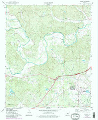
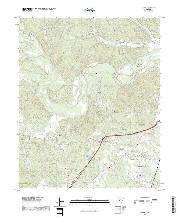
Haskell and the western edge of Benton are the primary focal points of this Saline County study, where the landscape transitions from established residential blocks to the waterways of the Saline River system. The Alum Fork Saline River and South Fork Saline River wind through the terrain, joined by numerous tributaries like Dotson Branch and Trace Creek. For genealogists and local historians, the area is punctuated by several family-named burial sites, including James Cem, Hammonds Cem, and Graham Cem, which provide specific points of reference for long-standing local lineages. The northern portion of the region near Kentucky is characterized by a dense network of timbered ridges and hollows such as Stillhouse Hollow, while the southern end shows the expanding road network around the Haskell community and the slopes of Rocky Mountain.
Find a feature on this map
132 named features on this map. Tap any name to fly to it.
Don’t see what you’re looking for? This feature index may not catch every label — zoom into the map to look around manually.
Map Details
Editions of this 2024 Haskell Map
This is the sole edition of this map. No revisions or reprints were ever made.