Old Maps of Hot Spring County, Arkansas
Explore 148 old maps of Hot Spring County, spanning from 1890 to today. These high-resolution historic maps reveal how streets, neighborhoods, landmarks, and natural features evolved over time — perfect for genealogy, metal detecting, research, and local history exploration.
What you can do with these maps:
- See how Hot Spring County changed over time: Compare historical maps to modern-day views to trace roads, homesites, rail lines & more.
- View detailed metadata: Each map includes creators, publishers, year, scale, and archive source.
- Overlay maps with satellite & LiDAR: Visualize the past alongside modern tools to explore terrain & human change.
- Trusted historical sources: Maps sourced from the USGS, Library of Congress, and other archives.
- Access maps your way: View online, download high-res files, or order prints for personal or research use.
Start exploring old maps of Hot Spring County to uncover forgotten places, hidden landmarks, and the deep history beneath your feet.
Hot Spring County, AR maps
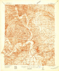
(148)- 1890 Map of Benton
 1890 Benton1890 Print · USGSSaline and Pulaski counties are shown here in the late nineteenth century as the rail network began to reshape the river-valley economy. Genealogists and researchers can trace family roots through old settlements like Brazils and Avilla or locate landmarks like Goosepond Mt and Aplin.
 - 1894 Map of Benton
 1894 Benton1894 Print · USGSCentral Arkansas in the late nineteenth century was a landscape of steep ridges and critical river crossings. Genealogists and researchers can trace the early rail corridor of the St. Louis Iron Mountain and Southern R. R. near Benton or locate family roots in Avilla and Brazils.5 unique versions available
 - 1938 Map of Benton
 1938 Benton1938 Print · USGSSaline County industry and rural life are captured here in the late 1930s, just as the Bauxite Mines were fueling the local economy. Researchers can trace family roots through numerous country churches like Grape Chapel or locate old river crossings such as Wray Ford and Daniels Ford.4 unique versions available
 - 1944 Map of Benton
 1944 Benton1944 Print · USGSSaline County in the mid-1940s centers on the industrial hub of Benton and the neighboring Bauxite Mines. Genealogists and historians can trace family roots through numerous rural landmarks like Grape Chapel, Pitkin Cem, and the State Hospital.
 - 1948 Map of Malvern, 1957 Print
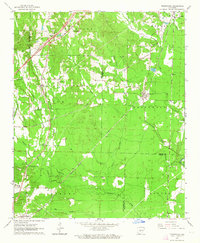
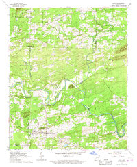
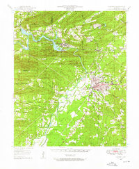 1948 Malvern1957 Print · USGSHot Spring County and the Ouachita River valley are captured here just after the war, showing the industrial growth and rural character of the region. Researchers can trace the development of Malvern and find vanished landmarks like Antioch Sch, Jones Mills, and the Rockport Cem.3 unique versions available
 - 1949 Map of Malvern
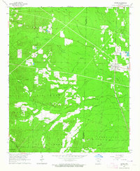
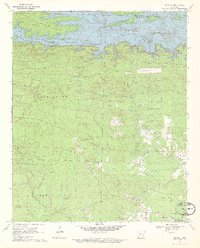
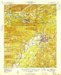 1949 Malvern1949 Print · USGSMalvern and the Ouachita River valley are shown here in the late 1940s, as industrial sites and new reservoirs began to reshape the Hot Spring County landscape. Genealogists and local historians can locate many rural landmarks, including Potash Sulphur Springs, Taylor Chapel, and the Price Cem.
 - 1955 Map of Little Rock, 1978 Print
 1955 Little Rock1978 Print · USGSCentral Arkansas in the mid-fifties exhibits a landscape of growing cities, massive military installations, and mountain reservoirs. Genealogists and historians can trace the industrial Bauxite Mines, regional rail lines, and local landmarks like Antioch Church.
 - 1956 Map of Little Rock
 1956 Little Rock1956 Print · USGSCentral Arkansas in the mid-fifties shows a landscape defined by burgeoning military bases and the timber-and-mineral wealth of the Ouachitas. Genealogists and researchers can trace old rail lines like the Missouri Pacific and find established communities such as Bauxite, Sheridan, and Mabelvale.
 - 1959 Map of Caddo Valley, 1960 Print
 1959 Caddo Valley1960 Print · USGSCentral Arkansas at the end of the fifties is defined by the convergence of the Caddo River and Ouachita River. Genealogists and historians can trace the foundations of Arkadelphia, from the Henderson State Teachers College campus to rural landmarks like Davis Cem and the Missouri Pacific rail line.3 unique versions available
 - 1960 Map of Little Rock
 1960 Little Rock1960 Print · USGSCentral Arkansas in the late fifties shows a landscape of growing military bases and massive new reservoirs. Local historians can trace the mid-century expansion of Little Rock and Hot Springs alongside the industrial works at Bauxite and the Pine Bluff Arsenal.
 - 1963 Map of Traskwood, 1964 Print
 1963 Traskwood1964 Print · USGSSaline and Hot Spring counties are captured here in the early sixties as new highway construction began to reshape the rural landscape. Genealogists and local historians can trace the foundations of Glen Rose, Francois, and Traskwood, alongside landmarks like Holy Ridge Ch and the Fairplay Cem.4 unique versions available
 - 1964 Map of Poyen
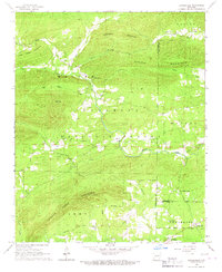
 1964 Poyen1964 Print · USGSThe borderlands of Grant and Hot Spring Counties come into focus in the mid-1960s, showing a landscape shaped by timber and rail. Genealogists and local historians can trace family locations near Poyen, Rhinehart, and landmarks like Huskey Ch or the Cunningham Cem.3 unique versions available
 - 1964 Map of Little Rock
 1964 Little Rock1964 Print · USGSCentral Arkansas in the mid-sixties is a landscape of mountain ridges, industrial rail lines, and growing military hubs. Researchers can trace the development of Bauxite and Hot Springs or locate rural landmarks like Sparkman and the Pine Bluff Arsenal.
 - 1964 Map of Donaldson, 1965 Print
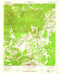
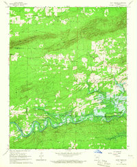
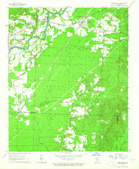 1964 Donaldson1965 Print · USGSHot Spring County’s river-and-rail landscape is captured here in the mid-sixties, centered on the activity of Donaldson and Friendship. Genealogists and local historians can trace rural roots through the locations of Mt Pleasant Cem, Riverside Ch, and the Ouachita High Sch.3 unique versions available
 - 1965 Map of Round Hill, 1966 Print
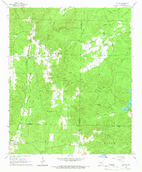
 1965 Round Hill1966 Print · USGSHot Spring and Dallas counties during the mid-1960s featured a network of logging trails and remote timberlands. Genealogists and hikers can trace the Clifton Tram, locate the Sardis Cem, or find rural landmarks like Pleasant Grove and Round Hill.2 unique versions available
 - 1965 Map of Willow, 1966 Print
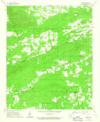
 1965 Willow1966 Print · USGSThe mid-Arkansas timberlands near the tri-county corner of Hot Spring, Grant, and Dallas counties are captured here in the mid-1960s. Researchers can trace rural lineages through the Chicago Rock Island and Pacific rail stops at Rolla and local landmarks like Hunters Chapel and Lono Cem.3 unique versions available
 - 1966 Map of Pearcy, 1967 Print
 1966 Pearcy1967 Print · USGSThe Ouachita foothills in the mid-sixties are captured here, showing the rural communities along the Garland and Hot Spring county line. Researchers can trace family sites near Bethlehem Ch, the Cross Roads Cem, or the old Railroad Grade near Pearcy.2 unique versions available
 - 1966 Map of Hempwallace, 1967 Print
 1966 Hempwallace1967 Print · USGSGarland and Hot Spring counties are shown during a period of transition in the late sixties as recreation grew around the river. Researchers can locate family landmarks like Oak Grove Cem and Aldrich Cem or trace the path of the Old Railroad Grade.2 unique versions available
 - 1966 Map of De Roche, 1967 Print
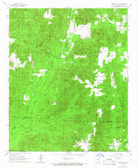
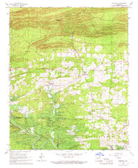
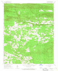 1966 De Roche1967 Print · USGSHot Spring County’s rural interior is captured here in the mid-sixties, from the heights of Jack Mountain to the flats of Montgomery Prairie. Researchers can trace local genealogy through several family burial sites like Estep Cem and Holstein Cem.
 - 1966 Map of Bonnerdale, 1967 Print
 1966 Bonnerdale1967 Print · USGSThe Ouachita foothills in the 1960s reveal a landscape of family-named cemeteries and decommissioned timber routes. Genealogists and historians can trace the Old Railroad Grade and locate historic community centers like Alamo, Old Bonnerdale, and Grants Chapel.
 - 1966 Map of Point Cedar, 1967 Print
 1966 Point Cedar1967 Print · USGSNear the Clark and Hot Spring county line in the mid-sixties, the river valley was undergoing a major transformation. Researchers can trace the original path of the Caddo River and locate rural landmarks like Wesleyan Chapel, Runyan Bridge, and Point Cedar.2 unique versions available
 - 1966 Map of Bismarck, 1967 Print
 1966 Bismarck1967 Print · USGSBismarck and the Caddo River valley are caught in a moment of transition during the mid-sixties as the local landscape prepares for the rising waters of the De Gray Reservoir. Genealogists and local historians can trace rural roots through several country churches like Pleasant Hill Ch and the De Roche Cem.2 unique versions available
 - 1966 Map of Hot Springs South, 1967 Print
 1966 Hot Springs South1967 Print · USGSHot Springs and the surrounding Arkansas lakelands are captured here in the mid-sixties, showing the growth of Lake Hamilton and the southern city limits. Researchers can trace historical landmarks including the Oaklawn Racetrack, the Fish Hatchery, and numerous local sites like New Hope Ch.5 unique versions available
 - 1966 Map of Amity, 1967 Print
 1966 Amity1967 Print · USGSAmity and the Caddo River valley are documented here in the mid-1960s, a period of transition for the rural landscapes of Clark and Montgomery counties. Family historians can trace the locations of Old Mt Tabor Ch, the Dillard Cem, and the path of the Missouri Pacific railroad.
 - 1970 Map of De Gray, 1972 Print
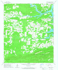
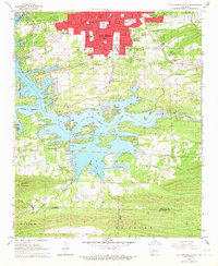
 1970 De Gray1972 Print · USGSNear the Arkansas foothills in the early seventies, the landscape shows the recent impact of the De Gray Reservoir on the Caddo River. Researchers can trace old family roots and rural networks through sites like Greenville, Golden Cemetery, and Hearn Church.3 unique versions available
Showing maps 1-25 of 148
Top cities of Hot Spring County
- Malvern historical maps
- Rockport historical maps
- Magnet Cove historical maps
- Midway historical maps
- Donaldson historical maps
- Perla historical maps
See more
Frequently asked questions
- What are the different types of historical maps available for Hot Spring County?
- What is the oldest map of Hot Spring County?
- Where can I purchase historical maps of Hot Spring County for my home or office?
- Where can I download high-res historical maps of Hot Spring County?
- Are there historical topographic maps available for Hot Spring County?
- Is there historical aerial imagery available for Hot Spring County?
- Where are historical maps of Hot Spring County sourced from?