
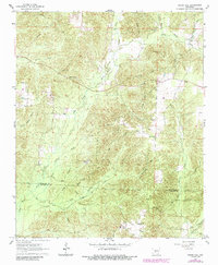
1965 Map of Round Hill
USGS Topo · Published 1966About this map
L'Eau Frais Creek and its many tributaries, including Greasy Creek and Easley Creek, dominate this landscape at the border of Hot Spring and Dallas counties. The area reflects a mid-20th-century transition between forestry and rural infrastructure, characterized by several remote churches such as Pleasant Hill Ch and Sardis Ch, the latter situated near the Sardis Cem.
Find a feature on this map
26 named features on this map. Tap any name to fly to it.
Don’t see what you’re looking for? This feature index may not catch every label — zoom into the map to look around manually.
Map Details
Editions of this 1965 Round Hill Map
2 editions found
Other maps of this area

1948 · Malvern
USGS Topo · 1:62,500

1949 · Malvern
USGS Topo · 1:62,500

1955 · Little Rock
USGS Topo · 1:250,000

1956 · Little Rock
USGS Topo · 1:250,000

1960 · Little Rock
USGS Topo · 1:250,000

1964 · Poyen
USGS Topo · 1:24,000

1964 · Little Rock
USGS Topo · 1:250,000

1964 · Donaldson
USGS Topo · 1:24,000
1965 · Willow
USGS Topo · 1:24,000
1965 · Dalark
USGS Topo · 1:24,000