
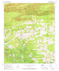
1966 Map of De Roche
USGS Topo · Published 1967About this map
Jack Mountain and the Antioch Hills dominate the northern and eastern portions of this mid-1960s landscape, while the lower elevations are defined by the broad expanse of Montgomery Prairie and the drainages of Prairie Bayou and De Roche Creek. The settlement patterns here reveal a deeply rooted rural community, anchored by numerous family-named burial grounds and houses of worship. Small enclaves like De Roche and Caney are interspersed with historical sites such as Prairie Bayou Ch, Hickory Grove Ch, and several small cemeteries including Prince Cem and Beason Cem. A Gravel Pit near De Lisle Creek points to local extractive activity during this era of Hot Spring County development.
Find a feature on this map
29 named features on this map. Tap any name to fly to it.
Don’t see what you’re looking for? This feature index may not catch every label — zoom into the map to look around manually.
Map Details
Editions of this 1966 De Roche Map
This is the sole edition of this map. No revisions or reprints were ever made.
Other maps of this area

1948 · Malvern
USGS Topo · 1:62,500

1949 · Malvern
USGS Topo · 1:62,500

1955 · Little Rock
USGS Topo · 1:250,000

1956 · Little Rock
USGS Topo · 1:250,000

1959 · Caddo Valley
USGS Topo · 1:24,000

1960 · Little Rock
USGS Topo · 1:250,000

1964 · Little Rock
USGS Topo · 1:250,000

1964 · Donaldson
USGS Topo · 1:24,000

1966 · Hempwallace
USGS Topo · 1:24,000
1966 · Bismarck
USGS Topo · 1:24,000