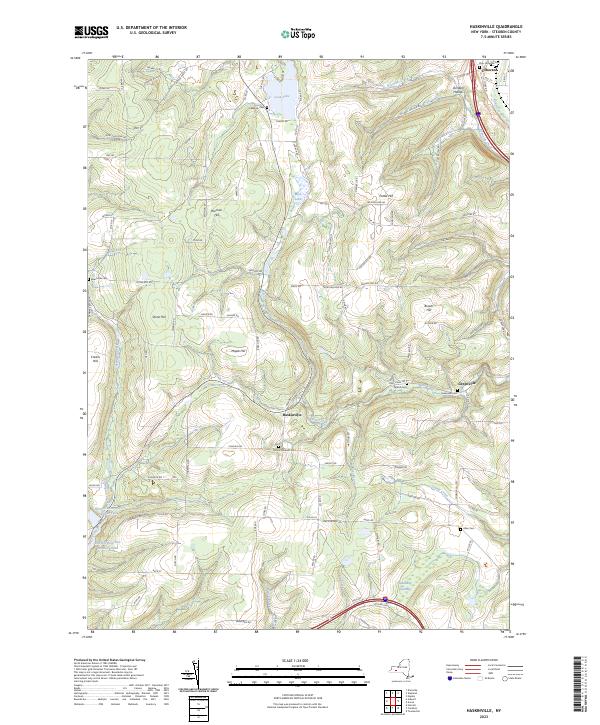
2023 Map of Haskinville
USGS Topo · Published 2023About this map
The rolling highlands of Steuben County center on the small settlement of Haskinville, where the valley of Neils Creek cuts through the surrounding ridges. This landscape is defined by its high-elevation terrain, including Bronson Hill, Stone Hill, and Maple Hill, which dictate the winding paths of rural routes like Smalt Rd and Derevees Rd. In the northeast corner, the Cohocton River valley provides a lower corridor for the village of Cohocton, while the southern reaches contain the Hornell Reservoir Number Two and Hornell Reservoir Number Three. Genealogists will find a high density of small burial grounds scattered throughout these hills, such as Mount Pleasant Cem and Beachville Cem. The natural drainage of the area is highlighted by Loon Lake and the Mud Lakes in the north, contrasting with the lowland Spauldling Swamp in the southeast.
Find a feature on this map
98 named features on this map. Tap any name to fly to it.
Don’t see what you’re looking for? This feature index may not catch every label — zoom into the map to look around manually.
Map Details
Editions of this 2023 Haskinville Map
This is the sole edition of this map. No revisions or reprints were ever made.
Other maps of this area

1900 · Naples
USGS Topo · 1:62,500

1902 · Wayland
USGS Topo · 1:62,500

1903 · Naples
USGS Topo · 1:62,500

1904 · Wayland
USGS Topo · 1:62,500

1910 · Bath
USGS Topo · 1:62,500

1913 · Naples
USGS Topo · 1:62,500

1915 · Hornell
USGS Topo · 1:62,500

1918 · Hornell
USGS Topo · 1:62,500

1942 · Wayland
USGS Topo · 1:31,680

1942 · Naples
USGS Topo · 1:31,680