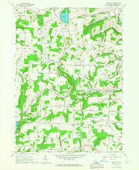
1965 Map of Haskinville
USGS Topo · Published 1967About this map
Loon Lake and its historic Loon Lake Chapel sit at the northern edge of this rural landscape, marking a terrain defined by steep-sided hills and deep creek valleys. The settlement of Haskinville serves as a central hub, where the Wesleyan Ch and a local School stand near the intersection of Davis Road and Church Rd. To the east, the Cohocton River valley carries the Erie Lackawanna RR, a vital transit corridor through the town of Cohocton.
Find a feature on this map
90 named features on this map. Tap any name to fly to it.
Don’t see what you’re looking for? This feature index may not catch every label — zoom into the map to look around manually.
Map Details
Editions of this 1965 Haskinville Map
This is the sole edition of this map. No revisions or reprints were ever made.
Other maps of this area

1900 · Naples
USGS Topo · 1:62,500

1902 · Wayland
USGS Topo · 1:62,500

1903 · Naples
USGS Topo · 1:62,500

1904 · Wayland
USGS Topo · 1:62,500

1910 · Bath
USGS Topo · 1:62,500

1913 · Naples
USGS Topo · 1:62,500

1915 · Hornell
USGS Topo · 1:62,500

1918 · Hornell
USGS Topo · 1:62,500

1942 · Wayland
USGS Topo · 1:31,680

1942 · Naples
USGS Topo · 1:31,680