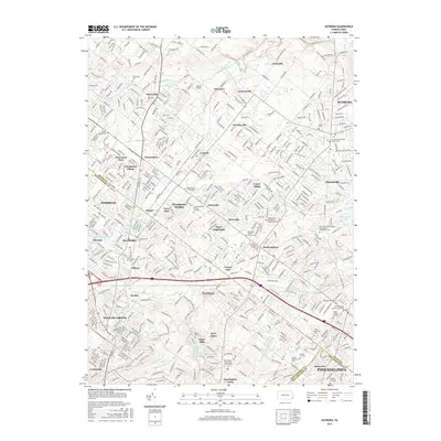
2016 Map of Hatboro
USGS Topo · Published 2016About this map
Bryn Athyn and the adjacent Bryn Athyn Coll of the New Church anchor the southern portion of this landscape, where the Pennypack Creek winds through a dense network of suburban development and historical sites. The 2016 geography reveals a deeply layered history of settlement and faith, preserved in numerous burial grounds such as the Craven VanSant Burying Grounds and the Warminster Friends Cem. The Pennsylvania Railroad corridor cuts through the center of the region, connecting established communities like Hatboro, Warminster, and Willow Grove. To the east, the waters of Springfield Lake and Ironworks Cr define the limits of Churchville and Southampton, while further north, smaller hamlets like Grenoble and Traymore maintain a distinct character near the Little Neshaminy Creek. This modern survey documents the evolution of the Bucks and Montgomery county lines, showing how old crossroads like Davisville and Johnsville have integrated into the contemporary metropolitan fabric.
Find a feature on this map
493 named features on this map. Tap any name to fly to it.
Don’t see what you’re looking for? This feature index may not catch every label — zoom into the map to look around manually.
Map Details
Editions of this 2016 Hatboro Map
This is the sole edition of this map. No revisions or reprints were ever made.
Other maps of this area

1890 · Lambertville
USGS Topo · 1:62,500

1890 · Doylestown
USGS Topo · 1:62,500

1890 · Burlington
USGS Topo · 1:62,500

1891 · Lambertville
USGS Topo · 1:62,500

1891 · Doylestown
USGS Topo · 1:62,500

1893 · Germantown
USGS Topo · 1:62,500

1893 · Burlington
USGS Topo · 1:62,500

1894 · Lambertville
USGS Topo · 1:62,500

1894 · Germantown
USGS Topo · 1:62,500

1896 · Germantown
USGS Topo · 1:62,500
Featured Places
- Philadelphia, PA
- Abington Township, PA
- Warminster Township, PA
- Horsham Township, PA
- Warrington Township, PA