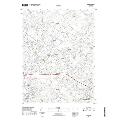
2019 Map of Hatboro
USGS Topo · Published 2019About this map
Hatboro and Willow Grove anchor this suburban landscape where the borders of Bucks, Montgomery, and Philadelphia counties converge. The area is dense with historical burial grounds and religious landmarks, including the Old School Baptist Meeting House Cem and the North and Southampton Churchyard / Churchville Cem. To the south, the spiritual and educational center of Bryn Athyn is visible, home to Bryn Athyn College and the winding Pennypack Creek. Transportation routes such as the Pennsylvania RR and the Old Jacksonville Rd illustrate the transit-oriented development patterns of the region. Distinctive small settlements like Ivyland, Johnsville, and Southampton are mapped alongside family-named landmarks like the Craven VanSant Burying Grounds and Harding Graveyard, providing significant points of interest for genealogists tracing early families in the northern Philadelphia suburbs.
Find a feature on this map
531 named features on this map. Tap any name to fly to it.
Don’t see what you’re looking for? This feature index may not catch every label — zoom into the map to look around manually.
Map Details
Editions of this 2019 Hatboro Map
This is the sole edition of this map. No revisions or reprints were ever made.
Other maps of this area

1890 · Lambertville
USGS Topo · 1:62,500

1890 · Doylestown
USGS Topo · 1:62,500

1890 · Burlington
USGS Topo · 1:62,500

1891 · Lambertville
USGS Topo · 1:62,500

1891 · Doylestown
USGS Topo · 1:62,500

1893 · Germantown
USGS Topo · 1:62,500

1893 · Burlington
USGS Topo · 1:62,500

1894 · Lambertville
USGS Topo · 1:62,500

1894 · Germantown
USGS Topo · 1:62,500

1896 · Germantown
USGS Topo · 1:62,500
Featured Places
- Philadelphia, PA
- Abington Township, PA
- Warminster Township, PA
- Horsham Township, PA
- Warrington Township, PA