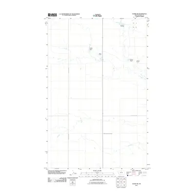
2011 Map of Havre NW
USGS Topo · Published 2011About this map
The North Havre Community Hall stands as a focal point for this rural landscape in Hill County, where the plains of northern Montana are etched by the winding drainages of Staton Coulee and Lohman Coulee. This 2011 survey reveals an agricultural environment defined by water management and localized farming infrastructure. Several small-scale reservoirs, including the Thibadeau Farm Dam, Kuntson Number 1 Dam, and Kuntson Number 2 Dam, dot the terrain, illustrating the critical role of water storage in this semi-arid region. These features, along with a grid of rural routes such as Willow Creek Rd and East End Colony Rd, provide a clear view of the modern land use patterns and community hubs that sustain life north of the Milk River.
Find a feature on this map
8 named features on this map. Tap any name to fly to it.
Don’t see what you’re looking for? This feature index may not catch every label — zoom into the map to look around manually.
Map Details
Editions of this 2011 Havre NW Map
This is the sole edition of this map. No revisions or reprints were ever made.
Other maps of this area

1904 · Havre
USGS Topo · 1:62,500

1904 · Assinniboine
USGS Topo · 1:62,500

1912 · Thibedeau Lake
USGS Topo · 1:125,000

1953 · Havre
USGS Topo · 1:250,000

1957 · Havre
USGS Topo · 1:250,000

1958 · Havre
USGS Topo · 1:250,000

1964 · Havre NW
USGS Topo · 1:24,000

1964 · Havre SE
USGS Topo · 1:24,000

1964 · Havre
USGS Topo · 1:24,000
1964 · Havre NE
USGS Topo · 1:24,000