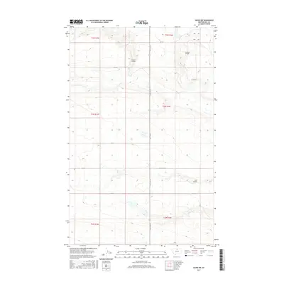
2017 Map of Havre NW
USGS Topo · Published 2017About this map
Staton Coulee and Lohman Coulee define the drainage patterns of this rural Hill County landscape, where the high plains are segmented by a strictly linear grid of section lines and gravel roads. North of Havre, the terrain is marked by the presence of Coal Coulee and organized around the central axis of Saint Joe Rd. This modern topographical study captures the vast open character of Montana's agricultural heartland, showing the precise distribution of rural infrastructure like E End Colony Rd and Rd 110 N. The map provides a detailed look at the township and range system, specifically within t34n r16e and surrounding blocks, which continue to dictate property boundaries and access routes through this prairie environment.
Find a feature on this map
17 named features on this map. Tap any name to fly to it.
Don’t see what you’re looking for? This feature index may not catch every label — zoom into the map to look around manually.
Map Details
Editions of this 2017 Havre NW Map
This is the sole edition of this map. No revisions or reprints were ever made.
Other maps of this area

1904 · Havre
USGS Topo · 1:62,500

1904 · Assinniboine
USGS Topo · 1:62,500

1912 · Thibedeau Lake
USGS Topo · 1:125,000

1953 · Havre
USGS Topo · 1:250,000

1957 · Havre
USGS Topo · 1:250,000

1958 · Havre
USGS Topo · 1:250,000

1964 · Havre NW
USGS Topo · 1:24,000

1964 · Havre SE
USGS Topo · 1:24,000

1964 · Havre
USGS Topo · 1:24,000
1964 · Havre NE
USGS Topo · 1:24,000