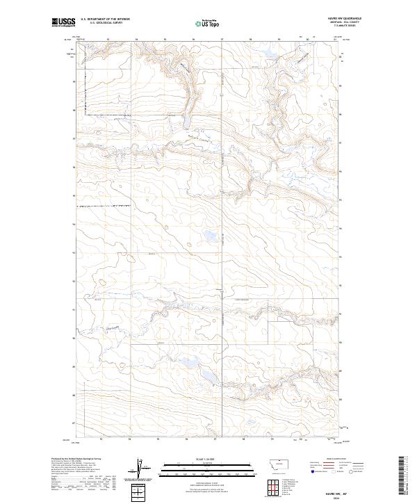
2024 Map of Havre NW
USGS Topo · Published 2024About this map
Lake Thibadeau National Wildlife Refuge anchors the northeastern corner of this Hill County landscape, where the high plains are carved by a series of dramatic glacial drainage channels. These northern Montana coulees, including Redrock Coulee and Staton Coulee, define the drainage patterns of the region and provide critical habitat within the shortgrass prairie. The sectional survey grid is bisected by long rural arteries such as Saint Joe Rd, which serves as a primary north-south connector through these townships. Local land use is further illustrated by smaller access routes like E End Colony Rd and RD 120 N, marking a landscape dedicated to large-scale ranching and conservation. The presence of Coal Coulee in the south and Lohman Coulee in the north highlights the recurring geological theme of these steep-walled seasonal stream beds across the plains.
Find a feature on this map
18 named features on this map. Tap any name to fly to it.
Don’t see what you’re looking for? This feature index may not catch every label — zoom into the map to look around manually.
Map Details
Editions of this 2024 Havre NW Map
This is the sole edition of this map. No revisions or reprints were ever made.
Other maps of this area

1904 · Havre
USGS Topo · 1:62,500

1904 · Assinniboine
USGS Topo · 1:62,500

1912 · Thibedeau Lake
USGS Topo · 1:125,000

1953 · Havre
USGS Topo · 1:250,000

1957 · Havre
USGS Topo · 1:250,000

1958 · Havre
USGS Topo · 1:250,000

1964 · Havre NW
USGS Topo · 1:24,000

1964 · Havre SE
USGS Topo · 1:24,000

1964 · Havre
USGS Topo · 1:24,000
1964 · Havre NE
USGS Topo · 1:24,000