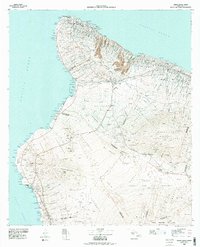
1980 Map of Hawaii County Sheet 1
USGS Topo · Published 1984About this map
Deep volcanic valleys like Waipio Valley and Waimanu Valley define the northern coast of the Big Island in the late 1970s. The landscape transition from the windward cliffs of the Kohala Mountains to the arid leeward coast is clearly visible through the density of forest reserves versus the open tracts of Puu Anahulu and Puu Wa Awaa. Significant land divisions, including Kalaoa-Ooma Homesteads and the Hokukano Mauka Tract, reveal the evolution of residential and agricultural patterns near Kailua and Keauhou.
Find a feature on this map
158 named features on this map. Tap any name to fly to it.
Don’t see what you’re looking for? This feature index may not catch every label — zoom into the map to look around manually.
Map Details
Editions of this 1980 Hawaii County Sheet 1 Map
This is the sole edition of this map. No revisions or reprints were ever made.
Other maps of this area

1913 · Kohala
USGS Topo · 1:62,500

1915 · Hamakua
USGS Topo · 1:62,500

1916 · Kohala
USGS Topo · 1:62,500

1916 · Waipio
USGS Topo · 1:62,500

1921 · Kilauea
USGS Topo · 1:62,500

1924 · Kilauea
USGS Topo · 1:62,500

1927 · Kaohe
USGS Topo · 1:62,500

1928 · Puako
USGS Topo · 1:62,500

1928 · Kailua
USGS Topo · 1:62,500

1928 · Mauna Loa
USGS Topo · 1:62,500