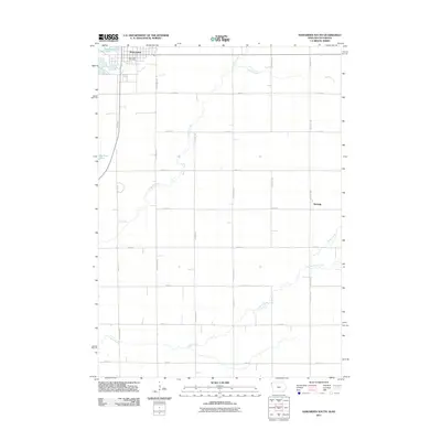
2011 Map of Hawarden South
USGS Topo · Published 2011About this map
The Big Sioux River forms a significant natural boundary on the western edge of this Sioux County landscape, carving through a region defined by its productive agricultural grid. In the northwest corner, the community of Hawarden serves as the primary hub, where the Hawarden Post Office remains a central landmark for the local population. The topography is shaped by a series of waterways, including the winding path of Sixmile Creek and the southern reaches of Indian Creek, which cut across the surveyed section lines. To the east, the small settlement of McNally is situated along the rural road network, illustrating the dispersed nature of Iowa's farming communities. This 2011 survey documents a modern rural landscape where traditional watercourses like Spring Creek and Dry Creek continue to influence land use and property boundaries within the established township and range system.
Find a feature on this map
28 named features on this map. Tap any name to fly to it.
Don’t see what you’re looking for? This feature index may not catch every label — zoom into the map to look around manually.
Map Details
Editions of this 2011 Hawarden South Map
This is the sole edition of this map. No revisions or reprints were ever made.
Other maps of this area

1897 · Canton
USGS Topo · 1:125,000

1898 · Elk Point
USGS Topo · 1:125,000

1900 · Canton
USGS Topo · 1:125,000

1901 · Elk Point
USGS Topo · 1:125,000

1907 · Elk Point
USGS Topo · 1:125,000

1955 · Sioux City
USGS Topo · 1:250,000

1955 · Sioux Falls
USGS Topo · 1:250,000

1958 · Sioux City
USGS Topo · 1:250,000

1958 · Sioux Falls
USGS Topo · 1:250,000

1959 · Sioux City
USGS Topo · 1:250,000