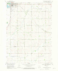
1969 Map of Hawarden South
USGS Topo · Published 1971About this map
Hawarden serves as the regional hub in this late 1960s study of the Iowa-South Dakota borderlands. The landscape is defined by its transit corridors, where the Chicago and North Western and Chicago Milwaukee St Paul and Pacific railroads intersect near the Missouri River Basin. This transportation network supported a rural economy of scattered farmsteads across townships like Logan, Washington, and Portland. The drainage patterns of the prairie are clearly visible, with Sixmile Creek and Indian Creek carving through the terrain south of the Hawarden Municipal Airport. Smaller settlements like McNally appear along the rail lines, while industrial activity is represented by a Gravel Pit and a Gaging Sta along the waterways, marking the intersection of natural drainage and human utility.
Find a feature on this map
18 named features on this map. Tap any name to fly to it.
Don’t see what you’re looking for? This feature index may not catch every label — zoom into the map to look around manually.
Map Details
Editions of this 1969 Hawarden South Map
This is the sole edition of this map. No revisions or reprints were ever made.
Other maps of this area

1897 · Canton
USGS Topo · 1:125,000

1898 · Elk Point
USGS Topo · 1:125,000

1900 · Canton
USGS Topo · 1:125,000

1901 · Elk Point
USGS Topo · 1:125,000

1907 · Elk Point
USGS Topo · 1:125,000

1955 · Sioux City
USGS Topo · 1:250,000

1955 · Sioux Falls
USGS Topo · 1:250,000

1958 · Sioux City
USGS Topo · 1:250,000

1958 · Sioux Falls
USGS Topo · 1:250,000

1959 · Sioux City
USGS Topo · 1:250,000