2021 Map of Hawk Point
USGS Topo · Published 2021About this map
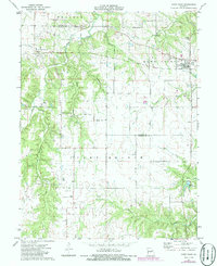
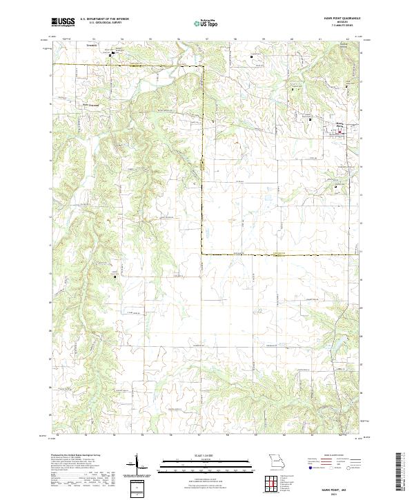
The borderlands of Lincoln and Warren Counties are defined by a network of rural homesteads and family cemeteries north of Lake Warrenton. The settlement of Hawk Point serves as a local hub near the eastern edge, while the older communities of Truxton and New Truxton anchor the northwestern portion of the map. This landscape is deeply carved by small waterways such as Bailey Branch and Turkey Creek, which separate the various farms and wooded hollows. Genealogists will find a high density of small family burial grounds, including the Owings - Pennington Cemetery and Anson Cemetery, often located on private land such as Eagles Nest Farm. The topography is a mix of agricultural plateaus and significant depressions, most notably Starkey Hollow and the area surrounding Cannon Spring, illustrating the characteristic drainage patterns of east-central Missouri.
Find a feature on this map
92 named features on this map. Tap any name to fly to it.
Don’t see what you’re looking for? This feature index may not catch every label — zoom into the map to look around manually.
Map Details
Editions of this 2021 Hawk Point Map
This is the sole edition of this map. No revisions or reprints were ever made.