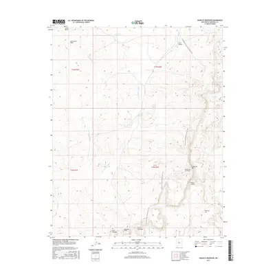
2017 Map of Headcut Reservoir
USGS Topo · Published 2017About this map
Headcut Reservoir and the Zambarmo Lake basin anchor this high-elevation landscape in Sandoval County, defined by a complex network of arroyos and dramatic mesa formations. The Continental Divide National Scenic Trail winds through the eastern half of the quadrangle, traversing a terrain of significant geological relief. Named landmarks like Deadman Peaks, La Ventana Mesa, and Cerro Colorado highlight the distinctive volcanic and sedimentary character of the region.
Find a feature on this map
23 named features on this map. Tap any name to fly to it.
Don’t see what you’re looking for? This feature index may not catch every label — zoom into the map to look around manually.
Map Details
Editions of this 2017 Headcut Reservoir Map
This is the sole edition of this map. No revisions or reprints were ever made.
Other maps of this area

1883 · Mt. Taylor
USGS Topo · 1:250,000

1886 · Mt. Taylor
USGS Topo · 1:250,000

1890 · Jemes
USGS Topo · 1:125,000

1892 · Jemes
USGS Topo · 1:125,000

1892 · Mt. Taylor
USGS Topo · 1:250,000

1899 · Mt. Taylor
USGS Topo · 1:250,000

1939 · La Ventana
USGS Topo · 1:62,500

1939 · San Ysidro
USGS Topo · 1:62,500

1943 · San Ysidro
USGS Topo · 1:62,500

1943 · La Ventana
USGS Topo · 1:62,500