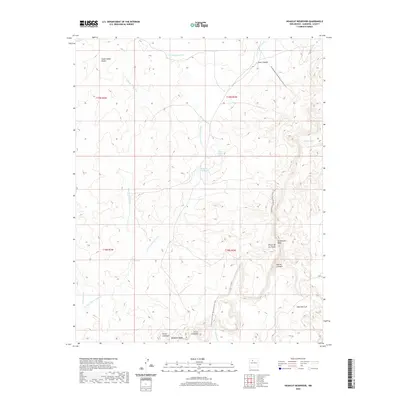
2020 Map of Headcut Reservoir
USGS Topo · Published 2020About this map
Arroyo Piedra-Lumbre and Cañada Candelaria define the high-desert drainage patterns of this Sandoval County landscape, where water management is central to the terrain's utility. The eponymous Headcut Reservoir sits at the heart of a network of seasonal water features, including Piedra-Lumbre Spring and Patilla Tank, which have historically supported livestock in this arid region. The topography is dominated by significant elevations such as La Ventana Mesa, Mesa San Luis, and the distinctive Deadman Peaks to the south. Modern recreational access is highlighted by the Continental Divide National Scenic Trail, which winds through the eastern portion of the map, crossing Jones Canyon and the slopes of Rincón de los Viejos. This map provides a clear look at the intersection of traditional land use and protected scenic corridors.
Find a feature on this map
23 named features on this map. Tap any name to fly to it.
Don’t see what you’re looking for? This feature index may not catch every label — zoom into the map to look around manually.
Map Details
Editions of this 2020 Headcut Reservoir Map
This is the sole edition of this map. No revisions or reprints were ever made.
Other maps of this area

1883 · Mt. Taylor
USGS Topo · 1:250,000

1886 · Mt. Taylor
USGS Topo · 1:250,000

1890 · Jemes
USGS Topo · 1:125,000

1892 · Jemes
USGS Topo · 1:125,000

1892 · Mt. Taylor
USGS Topo · 1:250,000

1899 · Mt. Taylor
USGS Topo · 1:250,000

1939 · La Ventana
USGS Topo · 1:62,500

1939 · San Ysidro
USGS Topo · 1:62,500

1943 · San Ysidro
USGS Topo · 1:62,500

1943 · La Ventana
USGS Topo · 1:62,500