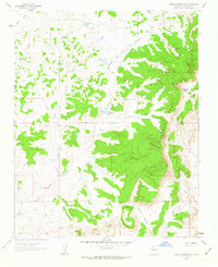
1961 Map of Headcut Reservoir
USGS Topo · Published 1963About this map
La Ventana Mesa dominates the eastern half of this Sandoval County landscape, where the high desert plateau gives way to complex drainage networks. This 1961 field-checked survey reveals a territory defined by intermittent water sources and livestock infrastructure, including the Headcut Reservoir and the Montoya Well. The mapping of several springs, such as Piedra Lumbre Spring, with specific notations of being polluted, provides a rare glimpse into the environmental conditions and water quality challenges of the era. To the south, the terrain rises toward the distinct summits of Deadman Peaks and Cerro Colorado, while the northern reaches feature Zambarm Lake. A solitary Mine symbol on Leandro Mesa indicates localized resource extraction amidst the ranching land, which is otherwise marked by various catchments like Padilla Tank and named drainages like Arroyo Piedra Lumbre.
Find a feature on this map
24 named features on this map. Tap any name to fly to it.
Don’t see what you’re looking for? This feature index may not catch every label — zoom into the map to look around manually.
Map Details
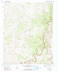
Editions of this 1961 Headcut Reservoir Map
2 editions found
Other maps of this area

1883 · Mt. Taylor
USGS Topo · 1:250,000

1886 · Mt. Taylor
USGS Topo · 1:250,000

1890 · Jemes
USGS Topo · 1:125,000

1892 · Jemes
USGS Topo · 1:125,000

1892 · Mt. Taylor
USGS Topo · 1:250,000

1899 · Mt. Taylor
USGS Topo · 1:250,000

1939 · La Ventana
USGS Topo · 1:62,500

1939 · San Ysidro
USGS Topo · 1:62,500

1943 · San Ysidro
USGS Topo · 1:62,500

1943 · La Ventana
USGS Topo · 1:62,500