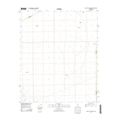
2013 Map of Heart of the Sands NW
USGS Topo · Published 2013About this map
White Sands dominates the northeastern corner of this high-desert landscape, where the shifting gypsum dunes meet the expansive Tularosa Valley. This 2013 survey illustrates the stark geography of the northern Chihuahuan Desert, defined by its massive salt basins and specialized military access. The southeastern terrain is marked by the Alkali Flat, a remnant of the ancient Lake Otero, which provides a level, mineral-crusted surface between the mountain ranges. Human presence is sparse and primarily infrastructure-based, centered on WSMR P Route 7, reflecting the area's role within the White Sands Missile Range. The map also delineates the administrative intersection of three counties, showing where the boundaries of Sierra, Doña Ana, and Otero meet amidst the sagebrush and salt flats.
Find a feature on this map
10 named features on this map. Tap any name to fly to it.
Don’t see what you’re looking for? This feature index may not catch every label — zoom into the map to look around manually.
Map Details
Editions of this 2013 Heart of the Sands NW Map
This is the sole edition of this map. No revisions or reprints were ever made.
Other maps of this area

1916 · Tonuco
USGS Topo · 1:125,000

1916 · Salinas Peak
USGS Topo · 1:125,000

1916 · Tularosa
USGS Topo · 1:125,000

1916 · Point Of Sands
USGS Topo · 1:125,000

1932 · Tonuco
USGS Topo · 1:125,000

1947 · Point Of Sands 2
USGS Topo · 1:62,500

1948 · Kaylor Mountain
USGS Topo · 1:62,500

1948 · Black Top Mountain
USGS Topo · 1:62,500

1948 · Lumley Lake
USGS Topo · 1:62,500

1954 · Tularosa
USGS Topo · 1:250,000