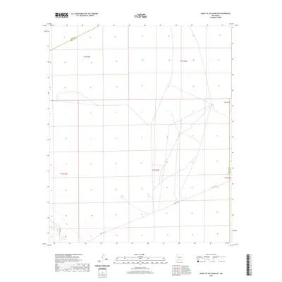
2020 Map of Heart of the Sands NW
USGS Topo · Published 2020About this map
The Alkali Flat landscape dominates the northeastern portion of this study in New Mexico’s high desert, revealing a sparse and specialized terrain within the Tularosa Basin. This 2020 survey documents a section of the White Sands region where the landscape is defined more by its vast natural expanses than by permanent settlement. The map identifies key transportation corridors such as Wsmr P RT 10 and Wsmr P RT 7, roads that traverse the basin floor through Doña Ana County. The intersection of multiple township and range lines, including t16s r5e and t15s r5e, illustrates the systematic grid overlaying this arid environment. The scarcity of named landmarks highlights the area's protected and specialized status, focusing on the essential desert tracks and the geographic transition at the Alkali Flat.
Find a feature on this map
10 named features on this map. Tap any name to fly to it.
Don’t see what you’re looking for? This feature index may not catch every label — zoom into the map to look around manually.
Map Details
Editions of this 2020 Heart of the Sands NW Map
This is the sole edition of this map. No revisions or reprints were ever made.
Other maps of this area

1916 · Tonuco
USGS Topo · 1:125,000

1916 · Salinas Peak
USGS Topo · 1:125,000

1916 · Tularosa
USGS Topo · 1:125,000

1916 · Point Of Sands
USGS Topo · 1:125,000

1932 · Tonuco
USGS Topo · 1:125,000

1947 · Point Of Sands 2
USGS Topo · 1:62,500

1948 · Kaylor Mountain
USGS Topo · 1:62,500

1948 · Black Top Mountain
USGS Topo · 1:62,500

1948 · Lumley Lake
USGS Topo · 1:62,500

1954 · Tularosa
USGS Topo · 1:250,000