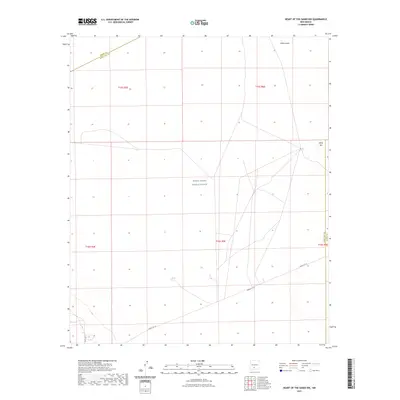
2023 Map of Heart of the Sands NW
USGS Topo · Published 2023About this map
White Sands Missile Range occupies the central expanse of this modern topographic survey, illustrating a landscape defined by restricted access and geological transition. The eastern edge of the quadrangle showcases the iconic White Sands gypsum dunes and the stark, evaporative basin of Alkali Flat. This area is marked by a network of specialized military infrastructure, including restricted transit corridors such as Wsmr P Rt 10 and Wsmr P Rt 7. The intersection of multiple township and range lines across Sierra and Doña Ana counties highlights the complex administrative and land-management boundaries within the Tularosa Basin. The lack of traditional permanent settlements reflects the area's specialized role in national defense and the preservation of its unique arid environment.
Find a feature on this map
12 named features on this map. Tap any name to fly to it.
Don’t see what you’re looking for? This feature index may not catch every label — zoom into the map to look around manually.
Map Details
Editions of this 2023 Heart of the Sands NW Map
This is the sole edition of this map. No revisions or reprints were ever made.
Other maps of this area

1916 · Tonuco
USGS Topo · 1:125,000

1916 · Salinas Peak
USGS Topo · 1:125,000

1916 · Tularosa
USGS Topo · 1:125,000

1916 · Point Of Sands
USGS Topo · 1:125,000

1932 · Tonuco
USGS Topo · 1:125,000

1947 · Point Of Sands 2
USGS Topo · 1:62,500

1948 · Kaylor Mountain
USGS Topo · 1:62,500

1948 · Black Top Mountain
USGS Topo · 1:62,500

1948 · Lumley Lake
USGS Topo · 1:62,500

1954 · Tularosa
USGS Topo · 1:250,000