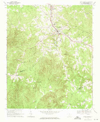
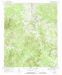
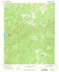
1968 Map of Heath Springs
USGS Topo · Published 1971About this map
Hanging Rock Battleground stands as a significant historical anchor in this portion of the Piedmont, marking a Revolutionary War site south of Heath Springs. The landscape is defined by the headwaters of Little Lynches Creek and Rock Creek, with the Southern railroad corridor providing the primary industrial spine for settlements like Stoneboro. Local social life in the late 1960s appears centered around numerous rural congregations and schools, including Flint Ridge Ch, Hillside High Sch, and Thorn Hill Ch. The presence of the State Fish Hatchery and several active quarries suggests a mix of state-managed resources and local extractive industry. Genealogists will find particular value in the scattered burial grounds such as Hammond Cem and Rock Hill Cem, which are tucked away near the winding paths of Beaver Creek and Showerbath Branch.
Find a feature on this map
42 named features on this map. Tap any name to fly to it.
Don’t see what you’re looking for? This feature index may not catch every label — zoom into the map to look around manually.
Map Details
Editions of this 1968 Heath Springs Map
2 editions found
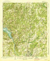
Other maps of this area
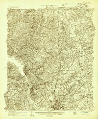
1935 · Camden
USGS Topo · 1:48,000
1938 · Camden
USGS Topo · 1:62,500

1941 · Spartanburg
USGS Topo · 1:250,000

1942 · Camden
USGS Topo · 1:125,000

1953 · Spartanburg
USGS Topo · 1:250,000

1960 · Spartanburg
USGS Topo · 1:250,000

1963 · Spartanburg
USGS Topo · 1:250,000

1964 · Spartanburg
USGS Topo · 1:250,000
1968 · Lancaster SE
USGS Topo · 1:24,000
1969 · Kershaw
USGS Topo · 1:24,000