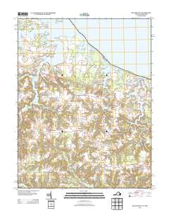
2013 Map of Heathsville
USGS Topo · Published 2013About this map
Heathsville and the surrounding Northern Neck peninsula are defined by a complex network of tidal creeks and rivers draining into the Potomac River. The settlement pattern follows the high ground between these waterways, with numerous named crossroads like Claraville, Middletons Corner, and Horse Head serving as local hubs. This 2013 survey illustrates the enduring agricultural and maritime character of the region, where the historical reliance on water power is still visible in the form of Bush Mill, Crabbe Mill, and several large millponds such as Sydnors Millpond and Clark Millpond.
Find a feature on this map
124 named features on this map. Tap any name to fly to it.
Don’t see what you’re looking for? This feature index may not catch every label — zoom into the map to look around manually.
Map Details
Editions of this 2013 Heathsville Map
This is the sole edition of this map. No revisions or reprints were ever made.
Other maps of this area

1892 · Piney Point
USGS Topo · 1:62,500

1894 · Piney Point
USGS Topo · 1:62,500

1894 · Point Lookout
USGS Topo · 1:62,500

1895 · Nomini
USGS Topo · 1:125,000

1895 · Piney Point
USGS Topo · 1:62,500

1898 · Nomini
USGS Topo · 1:125,000

1898 · St. Marys
USGS Topo · 1:125,000

1901 · Piney Point
USGS Topo · 1:62,500

1906 · St. Marys
USGS Topo · 1:125,000

1912 · Point Lookout
USGS Topo · 1:62,500