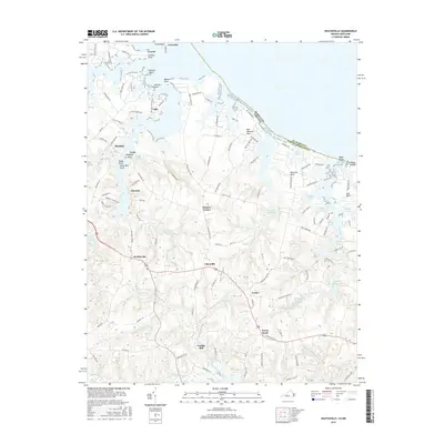
2016 Map of Heathsville
USGS Topo · Published 2016About this map
Heathsville serves as a central hub in this corner of the Northern Neck, where the land is defined by the deep indentations of the Potomac River and the Great Wicomico River. The landscape reveals a legacy of local industry tied to its waterways, evidenced by numerous historical mill sites such as Clark Millpond, Sydnors Millpond, and Downings Millpond. These water bodies, along with the Crabbe Mill Stream near the settlement of Crabbe Mill, reflect an era when local processing of timber or grain was central to the rural economy.
Find a feature on this map
122 named features on this map. Tap any name to fly to it.
Don’t see what you’re looking for? This feature index may not catch every label — zoom into the map to look around manually.
Map Details
Editions of this 2016 Heathsville Map
This is the sole edition of this map. No revisions or reprints were ever made.
Other maps of this area

1892 · Piney Point
USGS Topo · 1:62,500

1894 · Piney Point
USGS Topo · 1:62,500

1894 · Point Lookout
USGS Topo · 1:62,500

1895 · Nomini
USGS Topo · 1:125,000

1895 · Piney Point
USGS Topo · 1:62,500

1898 · Nomini
USGS Topo · 1:125,000

1898 · St. Marys
USGS Topo · 1:125,000

1901 · Piney Point
USGS Topo · 1:62,500

1906 · St. Marys
USGS Topo · 1:125,000

1912 · Point Lookout
USGS Topo · 1:62,500