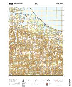
2019 Map of Heathsville
USGS Topo · Published 2019About this map
The Northumberland County Courthouse serves as the focal point for this section of the Northern Neck, where the landscape is defined by the intricate fingers of the Coan River and Hull Creek reaching inland from the Potomac. Small settlements like Heathsville, Claraville, and Sissons Corner are connected by a network of rural roads that skirt the numerous millponds and tidal inlets characteristic of the Virginia tidewater.
Find a feature on this map
132 named features on this map. Tap any name to fly to it.
Don’t see what you’re looking for? This feature index may not catch every label — zoom into the map to look around manually.
Map Details
Editions of this 2019 Heathsville Map
This is the sole edition of this map. No revisions or reprints were ever made.
Other maps of this area

1892 · Piney Point
USGS Topo · 1:62,500

1894 · Piney Point
USGS Topo · 1:62,500

1894 · Point Lookout
USGS Topo · 1:62,500

1895 · Nomini
USGS Topo · 1:125,000

1895 · Piney Point
USGS Topo · 1:62,500

1898 · Nomini
USGS Topo · 1:125,000

1898 · St. Marys
USGS Topo · 1:125,000

1901 · Piney Point
USGS Topo · 1:62,500

1906 · St. Marys
USGS Topo · 1:125,000

1912 · Point Lookout
USGS Topo · 1:62,500