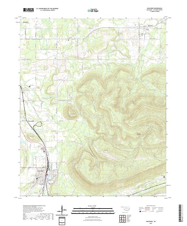
2022 Map of Heavener
USGS Topo · Published 2022About this map
Poteau Mountain dominates the eastern landscape of this Le Flore County quadrangle, where the terrain drops sharply toward the valley floor and the established city of Heavener. The community’s residential grid is clearly defined, featuring localized details like Heavener Memorial Park and several family or community burial grounds including Hill Cem and Oakdale Cem. This modern survey illustrates the persistent rural-to-urban transition of the area, with smaller settlements like Monroe and Forest Hill serving as satellite communities connected by a network of county roads. The drainage patterns are dictated by the surrounding peaks, with Sugarloaf Cr and Morris Cr carving through the valleys between Round Mtn and Mid Mtn. Genealogists and local historians will find value in the precise locations of outlying cemeteries such as Springhill Cem and Burns Cem, which mark the historical footprint of early settlements across the township lines.
Find a feature on this map
92 named features on this map. Tap any name to fly to it.
Don’t see what you’re looking for? This feature index may not catch every label — zoom into the map to look around manually.
Map Details
Editions of this 2022 Heavener Map
This is the sole edition of this map. No revisions or reprints were ever made.
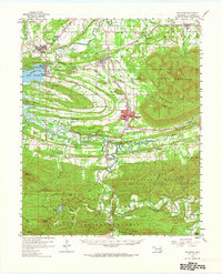
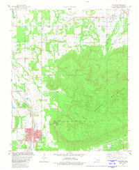
Historical Maps of Poteau Through Time
3 maps found