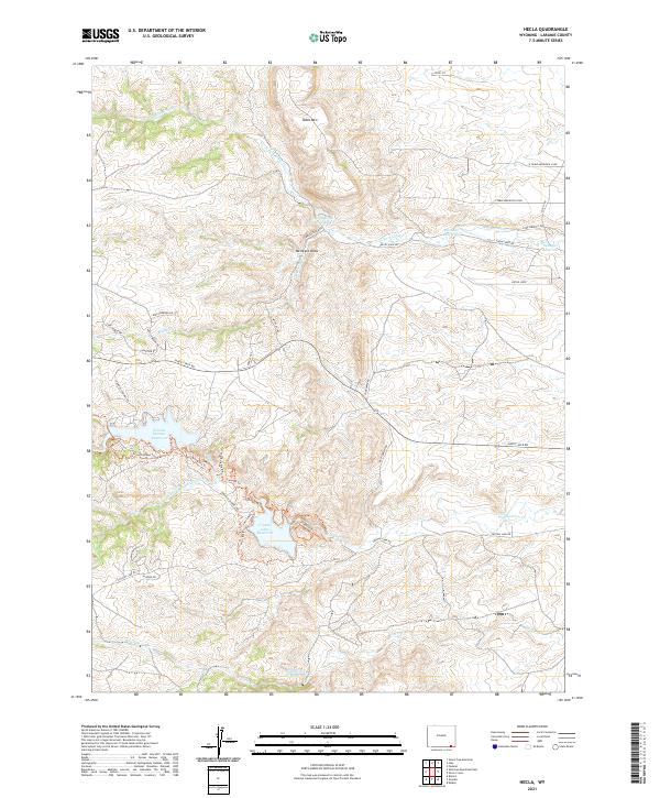
2021 Map of Hecla
USGS Topo · Published 2021About this map
Crystal Lake Reservoir and Granite Springs Reservoir dominate the high-elevation drainage of this Laramie County landscape, where water management is central to the land's utility. This modern 2021 survey reveals a complex network of reservoirs and diversions, including the North Crow Diversion Reservoir and South Crow Cr Reservoir, connected by water features like the Whitney Ditch. The terrain is defined by prominent elevations such as Table Mtn and the deep cut of Mcintyre Draw. The area is interlaced with a dense system of recreational and service routes, from the primary Happy Jack Rd to a variety of named paths like Granite Ridge Trl and Middle Kingdom Trl. These trails weave through the watershed of the N Fork Crow Cr and Middle Crow Cr, illustrating how the modern landscape balances infrastructure with public access.
Find a feature on this map
49 named features on this map. Tap any name to fly to it.
Don’t see what you’re looking for? This feature index may not catch every label — zoom into the map to look around manually.
Map Details
Editions of this 2021 Hecla Map
This is the sole edition of this map. No revisions or reprints were ever made.
Other maps of this area

1905 · Sherman
USGS Topo · 1:125,000

1948 · Sherman Mountains
USGS Topo · 1:62,500

1948 · Ragged Top Mountain
USGS Topo · 1:62,500

1950 · Ragged Top Mountain
USGS Topo · 1:62,500

1950 · Sherman Mountains
USGS Topo · 1:62,500

1954 · Cheyenne
USGS Topo · 1:250,000

1958 · Cheyenne
USGS Topo · 1:250,000

1962 · Federal
USGS Topo · 1:24,000
1962 · Silver Crown
USGS Topo · 1:24,000
1962 · Hecla
USGS Topo · 1:24,000