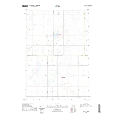
2020 Map of Hecla NE
USGS Topo · Published 2020About this map
Portage Detroit Ditch defines the low-lying prairie hydrology of this border region where South Dakota meets North Dakota. This 2020 survey illustrates a strictly organized agricultural landscape, partitioned by the Public Land Survey System into townships including t128n r60w, t128n r61w, t129n r59w, and t129n r58w. The terrain is characterized by numerous small seasonal wetlands and depressions typical of the glacial till plains, which are navigated by a rigid grid of section-line roads. The jurisdictional complexity of the area is highlighted by the intersection of three counties — Dickey Co, Sargent Co, and Brown Co — along the state boundary marked by Dickey Co State Line Rd. This map serves as a contemporary record of the drainage patterns and transportation network used to manage this productive borderland.
Find a feature on this map
30 named features on this map. Tap any name to fly to it.
Don’t see what you’re looking for? This feature index may not catch every label — zoom into the map to look around manually.
Map Details
Editions of this 2020 Hecla NE Map
This is the sole edition of this map. No revisions or reprints were ever made.
Other maps of this area

1894 · Hecla
USGS Topo · 1:62,500

1894 · Oakes
USGS Topo · 1:62,500

1895 · Lamoure
USGS Topo · 1:125,000

1896 · Columbia
USGS Topo · 1:125,000

1918 · La Moure
USGS Topo · 1:125,000

1953 · Jamestown
USGS Topo · 1:250,000

1953 · Hecla SE
USGS Topo · 1:24,000

1953 · Houghton
USGS Topo · 1:24,000

1953 · Newark SW
USGS Topo · 1:24,000

1953 · Milbank
USGS Topo · 1:250,000