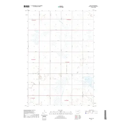
2017 Map of Hecla SE
USGS Topo · Published 2017About this map
Detroit sits as a quiet landmark in the prairie landscape of northeastern Brown County, defined by its traditional grid of rural section lines. The settlement is anchored by the Detroit Cem, a vital point for genealogists and local historians tracing the families who established the homesteads across T127N and R60W. This 2017 survey reflects the persistent agricultural character of the region, where water management is central to the land's utility. The Portage Detroit Ditch and the Crow Cr Drainage Ditch channel water through the low-lying terrain, while the Renzienhausen Slough remains a prominent natural hydrologic feature in the eastern sections. The map preserves the exact alignment of county infrastructure, from Co Rd 20 to the numbered avenues like 408th Ave, providing a precise reference for the contemporary layout of these historic townships.
Find a feature on this map
25 named features on this map. Tap any name to fly to it.
Don’t see what you’re looking for? This feature index may not catch every label — zoom into the map to look around manually.
Map Details
Editions of this 2017 Hecla SE Map
This is the sole edition of this map. No revisions or reprints were ever made.
Other maps of this area

1894 · Hecla
USGS Topo · 1:62,500

1896 · Columbia
USGS Topo · 1:125,000

1953 · Hecla SE
USGS Topo · 1:24,000

1953 · Houghton
USGS Topo · 1:24,000

1953 · Newark SW
USGS Topo · 1:24,000

1953 · Milbank
USGS Topo · 1:250,000

1954 · Daly Corners
USGS Topo · 1:24,000

1954 · Aberdeen
USGS Topo · 1:250,000

1956 · Aberdeen
USGS Topo · 1:250,000
1956 · Hecla
USGS Topo · 1:24,000
Featured Places
- Hecla Township, SD
- Portage Township, SD
- North Detroit Township, SD
- South Detroit Township, SD
- Shelby Township, SD