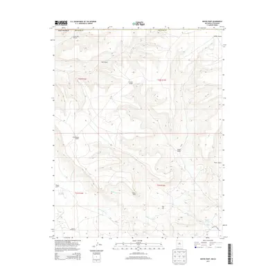
2013 Map of Heifer Point
USGS Topo · Published 2013About this map
Heifer Point stands as a prominent topographical landmark in this high-desert portion of northwestern New Mexico, characterized by a complex network of arroyos and canyons. The presence of the Verde Oil Field in the southern reaches of the quadrangle indicates the area's industrial importance for energy extraction during the early 21st century. Water management is a central theme in this arid environment, evidenced by Lost Lake Reservoir and various vital watering points including Squaw Spring, Navajo Spring, and Cottonwood Spring. Isolated landmarks like Windmill Number A-11 and Windmill Number A-12 suggest cattle grazing operations or local water supply infrastructure. Transport across this landscape is facilitated by Indian Service Route 205, while major drainages like Shumway Arroyo and Westwater Arroyo define the movement of water through the canyon systems of Salt Canyon and Cottonwood Canyon.
Find a feature on this map
25 named features on this map. Tap any name to fly to it.
Don’t see what you’re looking for? This feature index may not catch every label — zoom into the map to look around manually.
Map Details
Editions of this 2013 Heifer Point Map
This is the sole edition of this map. No revisions or reprints were ever made.
Other maps of this area

1889 · Chaco
USGS Topo · 1:250,000

1892 · Chaco
USGS Topo · 1:250,000

1912 · Soda Canyon
USGS Topo · 1:62,500

1915 · Soda Canyon
USGS Topo · 1:62,500

1934 · Chimney Rock
USGS Topo · 1:62,500

1936 · Chimney Rock
USGS Topo · 1:62,500

1954 · Shiprock
USGS Topo · 1:250,000

1956 · Cortez
USGS Topo · 1:250,000

1958 · Cortez
USGS Topo · 1:250,000

1958 · Shiprock
USGS Topo · 1:250,000