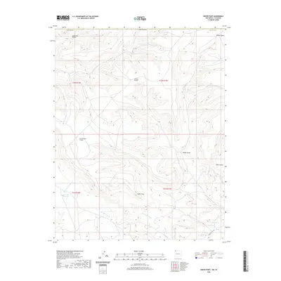
2020 Map of Heifer Point
USGS Topo · Published 2020About this map
Heifer Point serves as the central high ground in this arid San Juan County landscape, where an intricate network of drainage systems defines the movement of water across the high desert. Deep incisions like Straight Canyon and Cottonwood Canyon feed into major seasonal channels, including Shumway Arroyo and Salt Cr Wash. The presence of reliable water sources is evidenced by clustered landmarks such as Navajo Spring and Squaw Spring in the southeast, near the path of Indian Svc Rte 205. In the southwest corner, the Lost Lake Reservoir stands as a notable modification of the natural hydrology, capturing runoff from Eagle Nest Arroyo. This mapping detail illustrates the vital importance of spring locations and water management in this high-elevation corner of New Mexico.
Find a feature on this map
21 named features on this map. Tap any name to fly to it.
Don’t see what you’re looking for? This feature index may not catch every label — zoom into the map to look around manually.
Map Details
Editions of this 2020 Heifer Point Map
This is the sole edition of this map. No revisions or reprints were ever made.
Other maps of this area

1889 · Chaco
USGS Topo · 1:250,000

1892 · Chaco
USGS Topo · 1:250,000

1912 · Soda Canyon
USGS Topo · 1:62,500

1915 · Soda Canyon
USGS Topo · 1:62,500

1934 · Chimney Rock
USGS Topo · 1:62,500

1936 · Chimney Rock
USGS Topo · 1:62,500

1954 · Shiprock
USGS Topo · 1:250,000

1956 · Cortez
USGS Topo · 1:250,000

1958 · Cortez
USGS Topo · 1:250,000

1958 · Shiprock
USGS Topo · 1:250,000