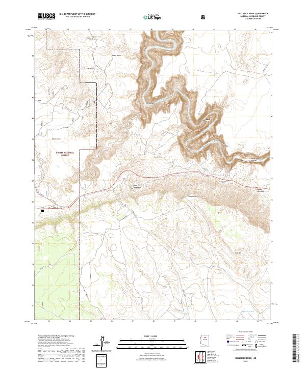
2021 Map of Hellhole Bend
USGS Topo · Published 2021About this map
The Little Colorado River carves a deep, winding path through the high desert plateau, creating dramatic geological formations like Hellhole Bend and the Little Colorado River Gorge. This landscape is defined by its sheer verticality, where the Coconino Rim overlooks the Upper Basin and Lower Basin. Within the Kaibab National Forest, the map traces layers of transit history, from the modern Great Western Trl to remnants of earlier infrastructure like Old Hwy 64 and the Old 64 Rd (Tusayan). These routes follow the natural contours of the rim, avoiding the steep descents into Dead Indian Canyon and Lee Canyon. Remote water sources such as Smiley Tank and geological landmarks like Saddle Horn Rock and Mule Shoe Bend highlight the importance of specific points for navigation and survival in this arid environment.
Find a feature on this map
28 named features on this map. Tap any name to fly to it.
Don’t see what you’re looking for? This feature index may not catch every label — zoom into the map to look around manually.
Map Details
Editions of this 2021 Hellhole Bend Map
This is the sole edition of this map. No revisions or reprints were ever made.
Other maps of this area

1886 · San Francisco Mtns
USGS Topo · 1:250,000

1886 · Echo Cliffs
USGS Topo · 1:250,000

1891 · San Francisco Mtns
USGS Topo · 1:250,000

1891 · Echo Cliffs
USGS Topo · 1:250,000

1894 · San Francisco Mtns
USGS Topo · 1:250,000

1899 · San Francisco Mtns
USGS Topo · 1:250,000

1907 · Vishnu
USGS Topo · 1:48,000

1947 · Flagstaff
USGS Topo · 1:250,000

1954 · Flagstaff
USGS Topo · 1:250,000

1955 · Coconino Pt SE
USGS Topo · 1:24,000