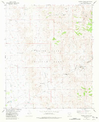
1981 Map of Hembrillo Basin
USGS Topo · Published 1981About this map
White Sands Missile Range dominates this landscape, showing a high-desert environment defined by the ridge and basin topography of the San Andres Mountains. The map highlights the historic Hembrillo Basin and the prominent Victorio Peak, a location of significant regional legend and lore. Local ranching and surveying history is evident through features like Blackshire and various livestock watering points such as Kaylor Tank and Green Valley Windmill.
Find a feature on this map
23 named features on this map. Tap any name to fly to it.
Don’t see what you’re looking for? This feature index may not catch every label — zoom into the map to look around manually.
Map Details
Editions of this 1981 Hembrillo Basin Map
This is the sole edition of this map. No revisions or reprints were ever made.
Other maps of this area

1916 · Tonuco
USGS Topo · 1:125,000

1916 · Salinas Peak
USGS Topo · 1:125,000

1932 · Tonuco
USGS Topo · 1:125,000

1948 · Sowell
USGS Topo · 1:62,500

1948 · Chicken Well
USGS Topo · 1:62,500

1948 · Kaylor Mountain
USGS Topo · 1:62,500

1948 · Black Top Mountain
USGS Topo · 1:62,500

1954 · Tularosa
USGS Topo · 1:250,000

1955 · Las Cruces
USGS Topo · 1:250,000

1958 · Las Cruces
USGS Topo · 1:250,000