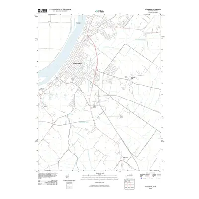
2010 Map of Henderson
USGS Topo · Published 2010About this map
Henderson occupies a prominent position on the south bank of the Ohio River, where the river's bend defines the northern edge of the city. The landscape transitions from the urban core and riverfront to a network of outlying communities like Anthoston and Rankin. The area is notably dense with burial grounds, including the historic Saint Louis Cemetery, Fernwood Cemetery, and the expansive Roselawn Memorial Gardens. The drainage pattern is heavily influenced by the winding Canoe Creek and its various tributaries, such as North Fork Canoe Creek and East Fork Canoe Creek, which carve through the terrain south of the city. Modern infrastructure, including the Audubon Pkwy and Breathitt Pkwy, highlights the region's role as a regional transportation hub, while local landmarks like Graham Hill and the Flying H Farms Airport ground the survey in its contemporary rural and suburban context.
Find a feature on this map
42 named features on this map. Tap any name to fly to it.
Don’t see what you’re looking for? This feature index may not catch every label — zoom into the map to look around manually.
Map Details
Editions of this 2010 Henderson Map
This is the sole edition of this map. No revisions or reprints were ever made.
Other maps of this area

1905 · Newburg
USGS Topo · 1:62,500

1906 · Sebree
USGS Topo · 1:62,500

1908 · Calhoun
USGS Topo · 1:62,500

1914 · Henderson
USGS Topo · 1:48,000

1916 · Henderson
USGS Topo · 1:62,500

1949 · Poole
USGS Topo · 1:24,000

1949 · Robards
USGS Topo · 1:24,000

1951 · Poole
USGS Topo · 1:24,000

1951 · Robards
USGS Topo · 1:24,000

1951 · Spottsville
USGS Topo · 1:24,000