
1951 Map of Spottsville
USGS Topo · Published 1953About this map
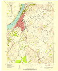
Spottsville and the winding Green River define this part of Henderson County during the early 1950s. The landscape is a mix of small rural centers and active resource extraction, evidenced by the numerous Oil Wells peppered across the terrain. Transport is centered on the Louisville and Nashville railroad corridor, which serves the riverside communities of Baskett and Beals. Local social life is anchored by several rural landmarks, including the County Training Sch and the Christodelphian Ch, while the Elam Ditch and Race Creek show the efforts to manage the low-lying drainage patterns near the river. The concentration of settlements like Zion and Hebbardsville illustrates a traditional Kentucky agricultural pattern transitioning into the mid-century industrial era.
Find a feature on this map
21 named features on this map. Tap any name to fly to it.
Don’t see what you’re looking for? This feature index may not catch every label — zoom into the map to look around manually.
Map Details
Editions of this 1951 Spottsville Map
This is the sole edition of this map. No revisions or reprints were ever made.
Other maps of this area

1905 · Newburg
USGS Topo · 1:62,500

1906 · Sebree
USGS Topo · 1:62,500

1908 · Calhoun
USGS Topo · 1:62,500

1914 · Henderson
USGS Topo · 1:48,000

1916 · Henderson
USGS Topo · 1:62,500

1949 · Robards
USGS Topo · 1:24,000

1951 · Robards
USGS Topo · 1:24,000

1951 · Yankeetown
USGS Topo · 1:24,000

1952 · Evansville
USGS Topo · 1:24,000
1952 · Henderson
USGS Topo · 1:24,000