
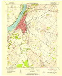
1952 Map of Evansville
USGS Topo · Published 1953About this map
The Ohio River curves sharply through this mid-century survey, defining the border between Indiana and Kentucky near Evansville. The landscape is dominated by complex river morphology, including a large Island and a series of backwater features such as Green Slough, Bee Slough, and Deep Slough. On the Kentucky side, the topography rises into the Wolf Hills, where Audubon Memorial State Park and Dresser Lake are located. This area shows a transition from the industrial and recreational focus of Dade Park to the small settlements of White City and Walker. The map also captures several family-named landmarks along the river plains, including Atkinson, Harding, and Mc Clair, providing a detailed look at the rural landholdings and floodplain agriculture of the early 1950s.
Find a feature on this map
23 named features on this map. Tap any name to fly to it.
Don’t see what you’re looking for? This feature index may not catch every label — zoom into the map to look around manually.
Map Details
Editions of this 1952 Evansville Map
This is the sole edition of this map. No revisions or reprints were ever made.
Other maps of this area

1901 · Haubstadt
USGS Topo · 1:62,500

1902 · Ditney
USGS Topo · 1:125,000

1902 · Boonville
USGS Topo · 1:62,500

1903 · Haubstadt
USGS Topo · 1:62,500

1903 · Patoka
USGS Topo · 1:125,000

1905 · Newburg
USGS Topo · 1:62,500

1914 · Henderson
USGS Topo · 1:48,000

1916 · Henderson
USGS Topo · 1:62,500

1951 · Spottsville
USGS Topo · 1:24,000
1952 · Henderson
USGS Topo · 1:24,000