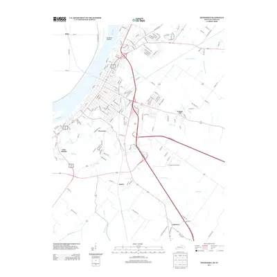
2013 Map of Henderson
USGS Topo · Published 2013About this map
The Ohio River dominates the western edge of this Kentucky-Indiana borderlands survey, defining the industrial and residential growth of the region. This 2013 landscape is marked by a complex network of drainage systems, including Canoe Cr, Sellers Ditch, and Elam Ditch, which manage the low-lying terrain east of the river. The map details the expansion of residential clusters such as Weaverton, Finley Addition, and Rankin, illustrating how mid-sized settlements have integrated with historic transportation corridors. Of particular note is the Henderson Towhead mid-river and the Flying H Farms Airport situated on the flatter southern reaches. The topography rises slightly toward Graham Hill, providing a contrast to the heavily managed watercourses like Barrett Ditch and Wilson Cr that crisscross the agricultural and developing lands south of the river bend.
Find a feature on this map
170 named features on this map. Tap any name to fly to it.
Don’t see what you’re looking for? This feature index may not catch every label — zoom into the map to look around manually.
Map Details
Editions of this 2013 Henderson Map
This is the sole edition of this map. No revisions or reprints were ever made.
Other maps of this area

1905 · Newburg
USGS Topo · 1:62,500

1906 · Sebree
USGS Topo · 1:62,500

1908 · Calhoun
USGS Topo · 1:62,500

1914 · Henderson
USGS Topo · 1:48,000

1916 · Henderson
USGS Topo · 1:62,500

1949 · Poole
USGS Topo · 1:24,000

1949 · Robards
USGS Topo · 1:24,000

1951 · Poole
USGS Topo · 1:24,000

1951 · Robards
USGS Topo · 1:24,000

1951 · Spottsville
USGS Topo · 1:24,000