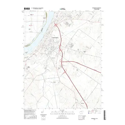
2016 Map of Henderson
USGS Topo · Published 2016About this map
Henderson serves as the focal point of this river-centered landscape, situated along the southern banks of the Ohio River. The city's residential and industrial layout is clearly defined, extending toward smaller satellite communities like Weaverton and Finley Addition. A network of drainage ditches, such as Sellers Ditch and Elam Ditch, underscores the importance of water management in this low-lying area. The map highlights numerous burial grounds reflecting the region's long-term settlement, including Saint Louis Cem, Fernwood Cem, and the more contemporary Roselawn Memorial Gardens. Agricultural and aviation land use intersect at the Flying H Farms Airport, while the rugged eastern terrain is marked by Graham Hill. To the south, rural clusters at Rankin and Anthoston indicate the transition from the urban core to the surrounding Henderson County farmland, with the Indiana Kentucky rail line providing a vital transport corridor across the state boundary.
Find a feature on this map
141 named features on this map. Tap any name to fly to it.
Don’t see what you’re looking for? This feature index may not catch every label — zoom into the map to look around manually.
Map Details
Editions of this 2016 Henderson Map
This is the sole edition of this map. No revisions or reprints were ever made.
Other maps of this area

1905 · Newburg
USGS Topo · 1:62,500

1906 · Sebree
USGS Topo · 1:62,500

1908 · Calhoun
USGS Topo · 1:62,500

1914 · Henderson
USGS Topo · 1:48,000

1916 · Henderson
USGS Topo · 1:62,500

1949 · Poole
USGS Topo · 1:24,000

1949 · Robards
USGS Topo · 1:24,000

1951 · Poole
USGS Topo · 1:24,000

1951 · Robards
USGS Topo · 1:24,000

1951 · Spottsville
USGS Topo · 1:24,000