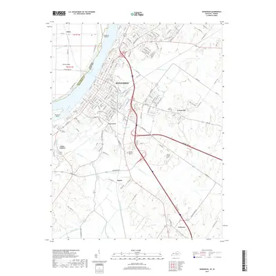
2019 Map of Henderson
USGS Topo · Published 2019About this map
The Ohio River forms a grand arc along the northern edge of this landscape, separating the Indiana and Kentucky borderlands near Henderson. This riverfront city serves as the primary hub, with its urban grid transitioning into suburban developments and rural acreage to the south and east. Historic burial grounds are prominent across the quadrangle, ranging from the central Fernwood Cem and Saint Louis Cem near the city core to the more outlying Mount Pisgah Cem on Graham Hill.
Find a feature on this map
153 named features on this map. Tap any name to fly to it.
Don’t see what you’re looking for? This feature index may not catch every label — zoom into the map to look around manually.
Map Details
Editions of this 2019 Henderson Map
This is the sole edition of this map. No revisions or reprints were ever made.
Other maps of this area

1905 · Newburg
USGS Topo · 1:62,500

1906 · Sebree
USGS Topo · 1:62,500

1908 · Calhoun
USGS Topo · 1:62,500

1914 · Henderson
USGS Topo · 1:48,000

1916 · Henderson
USGS Topo · 1:62,500

1949 · Poole
USGS Topo · 1:24,000

1949 · Robards
USGS Topo · 1:24,000

1951 · Poole
USGS Topo · 1:24,000

1951 · Robards
USGS Topo · 1:24,000

1951 · Spottsville
USGS Topo · 1:24,000