
1969 Map of Hennepin
USGS Topo · Published 1971About this map
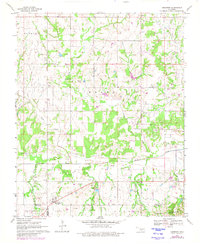
The Fort Arbuckle Ruins stand as a historical marker in the southeastern corner of this landscape, situated near Garrison Creek just north of the Arbuckle Mountains. In the late 1960s, the region was defined by a balance between rural community life and the industrial footprint of the petroleum industry, evidenced by the Elmore Oil Field and Brady Oil Field that stretch across the northern sections. A refinery and multiple pipelines underscore the area's economic focus during this era.
Find a feature on this map
27 named features on this map. Tap any name to fly to it.
Don’t see what you’re looking for? This feature index may not catch every label — zoom into the map to look around manually.
Map Details
Editions of this 1969 Hennepin Map
2 editions found
Other maps of this area

1898 · Pauls Valley
USGS Topo · 1:125,000

1901 · Ardmore
USGS Topo · 1:125,000

1902 · Pauls Valley
USGS Topo · 1:125,000

1918 · Ardmore
USGS Topo · 1:125,000

1957 · Ardmore
USGS Topo · 1:250,000

1963 · Ardmore
USGS Topo · 1:250,000

1964 · Turner Falls
USGS Topo · 1:24,000

1965 · Pauls Valley
USGS Topo · 1:24,000

1965 · Joy
USGS Topo · 1:24,000

1968 · Fox NE
USGS Topo · 1:24,000