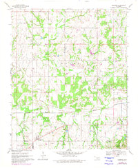
1969 Map of Hennepin
USGS Topo · Published 1980About this map
Hennepin and the surrounding rural landscapes of Garvin, Carter, and Murray counties are defined by a mix of agricultural pasture and active energy extraction during this late-1960s period. The map highlights a complex network of oil fields, including an on-site Refinery and numerous Oil Well symbols connected by an extensive Pipeline system. This industrial presence sits alongside the area's deep history, marked most notably by the Fort Arbuckle Ruins near the confluence of Garrison Creek and Wildhorse Creek.
Find a feature on this map
28 named features on this map. Tap any name to fly to it.
Don’t see what you’re looking for? This feature index may not catch every label — zoom into the map to look around manually.
Map Details
Editions of this 1969 Hennepin Map
2 editions found

Other maps of this area

1898 · Pauls Valley
USGS Topo · 1:125,000

1901 · Ardmore
USGS Topo · 1:125,000

1902 · Pauls Valley
USGS Topo · 1:125,000

1918 · Ardmore
USGS Topo · 1:125,000

1957 · Ardmore
USGS Topo · 1:250,000

1963 · Ardmore
USGS Topo · 1:250,000

1964 · Turner Falls
USGS Topo · 1:24,000

1965 · Pauls Valley
USGS Topo · 1:24,000

1965 · Joy
USGS Topo · 1:24,000

1968 · Fox NE
USGS Topo · 1:24,000