
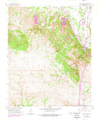
1964 Map of Turner Falls
USGS Topo · Published 1966About this map
The Arbuckle Mountains dominate this 1964 landscape, where the dramatic descent of Honey Creek creates a series of famous cascades including Turner Falls, Bridal Veil Falls, and Classen Falls. This area within Turner Falls Park shows a well-established recreation and travel corridor along the Washita River, featuring the Nazarene Camp, a Youth Camp, and Cedar Village. Transportation and infrastructure are in a state of transition, with a significant segment of highway marked as Under Construction slicing through the limestone hills.
Find a feature on this map
24 named features on this map. Tap any name to fly to it.
Don’t see what you’re looking for? This feature index may not catch every label — zoom into the map to look around manually.
Map Details
Editions of this 1964 Turner Falls Map
2 editions found
Other maps of this area

1898 · Pauls Valley
USGS Topo · 1:125,000

1901 · Ardmore
USGS Topo · 1:125,000

1902 · Pauls Valley
USGS Topo · 1:125,000

1918 · Ardmore
USGS Topo · 1:125,000

1957 · Ardmore
USGS Topo · 1:250,000

1963 · Ardmore
USGS Topo · 1:250,000
1964 · Gene Autry
USGS Topo · 1:24,000

1964 · Springer
USGS Topo · 1:24,000

1965 · Davis
USGS Topo · 1:24,000

1965 · Joy
USGS Topo · 1:24,000