Old Maps of Garvin County, Oklahoma
Explore 116 old maps of Garvin County, spanning from 1898 to today. These high-resolution historic maps reveal how streets, neighborhoods, landmarks, and natural features evolved over time — perfect for genealogy, metal detecting, research, and local history exploration.
What you can do with these maps:
- See how Garvin County changed over time: Compare historical maps to modern-day views to trace roads, homesites, rail lines & more.
- View detailed metadata: Each map includes creators, publishers, year, scale, and archive source.
- Overlay maps with satellite & LiDAR: Visualize the past alongside modern tools to explore terrain & human change.
- Trusted historical sources: Maps sourced from the USGS, Library of Congress, and other archives.
- Access maps your way: View online, download high-res files, or order prints for personal or research use.
Start exploring old maps of Garvin County to uncover forgotten places, hidden landmarks, and the deep history beneath your feet.
Garvin County, OK maps
(116)- 1898 Map of Pauls Valley, 1954 Print
 1898 Pauls Valley1954 Print · USGSThe Chickasaw Nation is documented at the turn of the century, showing the rail-driven growth of the Washita River valley. Researchers can trace early settlements like Whitebead and Wynnewood along the Gulf Colorado and Santa Fe RR.
 - 1901 Map of Stonewall
 1901 Stonewall1901 Print · USGSBefore Oklahoma statehood, this late-century survey captures the Chickasaw Nation and Seminole Nation borderlands in high detail. Researchers can locate early schools like Collins Institute and trace the paths between settlements such as Stonewall, Ada, and Fitzhugh.4 unique versions available
 - 1902 Map of Pauls Valley
 1902 Pauls Valley1902 Print · USGSThe Chickasaw Nation at the turn of the century shows a landscape of river-valley agriculture and burgeoning rail towns. Genealogists and historians can trace the early footprints of Pauls Valley, Wynnewood, and Whitebead before statehood.5 unique versions available
 - 1902 Map of Rush Springs
 1902 Rush Springs1902 Print · USGSThe Chickasaw Nation landscape at the turn of the century is defined by its deep river valleys and the arrival of the iron horse. Genealogists can trace early homesteads and rail-side growth in Rush Springs, Marlow, and settlements like Erin Springs along the Washita River.4 unique versions available
 - 1957 Map of Ardmore, 1968 Print
 1957 Ardmore1968 Print · USGSSouth-central Oklahoma in the late fifties was a landscape of rising reservoir waters and expanding rail lines. Genealogists and historians can trace the foundations of Ardmore and Duncan or locate early recreation sites at Platt National Park and Lake Murray State Park.3 unique versions available
 - 1963 Map of Ardmore
 1963 Ardmore1963 Print · USGSSouthern Oklahoma during the early sixties shows a landscape defined by the Arbuckle Mountains and a booming energy economy. Genealogists and historians can trace family-named sites across the Ardmore Oil Field, find old schools like Southeastern State College, or locate historic markers such as Boggy Depot State Park.2 unique versions available
 - 1964 Map of Byars, 1966 Print
 1964 Byars1966 Print · USGSOklahoma's central plains during the mid-sixties show a landscape of active extraction and old prairie settlements. Trace family roots through local landmarks like Dixon Chapel, Byars Cem, and the rail-side community of Boudinot along the Atchison Topeka and Santa Fe.2 unique versions available
 - 1965 Map of Pauls Valley NE, 1966 Print
 1965 Pauls Valley NE1966 Print · USGSGarvin County was a landscape of active petroleum production and rural community life in the mid-1960s. Genealogists and local historians can trace the exact locations of Cottrells Mission, Lewis Cem, and schools like Oak Dale Sch.2 unique versions available
 - 1965 Map of Byars SW, 1966 Print
 1965 Byars SW1966 Print · USGSGarvin County's river-and-rail landscape is captured here in the mid-1960s as oil production and water management reshaped the plains. Researchers can locate the Indian Meridian, the Pauls Valley Oil Field, and rural landmarks like Civit and Blue Branch Cem.3 unique versions available
 - 1965 Map of Pauls Valley, 1966 Print
 1965 Pauls Valley1966 Print · USGSGarvin County's river-and-rail corridor is captured here in the mid-sixties as the local economy balances agriculture with a thriving petroleum industry. Genealogists and historians can trace family-named landmarks including Mt Olive Cemetery, Oaklawn Cem, and the Hoover Oil Field.3 unique versions available
 - 1965 Map of Maysville, 1966 Print
 1965 Maysville1966 Print · USGSMaysville and the surrounding Washita River valley are captured in the mid-sixties during a period of steady industrial and agricultural activity. Genealogists and local historians can trace family locations near the Story Sch, Maysville Cemetery, and the local Refinery.3 unique versions available
 - 1965 Map of Joy, 1966 Print
 1965 Joy1966 Print · USGSThe Arbuckle Mountains and Washita River valley are captured here in the mid-1960s, showing a landscape defined by oil production and frontier history. Researchers can locate the Fort Arbuckle Ruins, trace the Gulf Colorado and Santa Fe rail line, or find family names at Butterfly Cem and Chigley.2 unique versions available
 - 1965 Map of Paoli, 1966 Print
 1965 Paoli1966 Print · USGSGarvin County's river valley and oil country are well-defined in the mid-sixties, showing the growth of Paoli and Whitebead. Researchers can trace the path of the Atchison Topeka and Santa Fe railroad or locate family sites like Florence Cem.2 unique versions available
 - 1966 Map of Lindsay, 1967 Print
 1966 Lindsay1967 Print · USGSThe Washita River valley in the mid-1960s was a landscape defined by the intersection of traditional farming and the petroleum boom. Local researchers can trace the Golden Trend Oil Field infrastructure alongside old landmarks like Erin Springs, the Hughes Sch, and Green Hill Cemetery.2 unique versions available
 - 1966 Map of Lindsay SW, 1967 Print
 1966 Lindsay SW1967 Print · USGSMid-century life in the Oklahoma plains is captured here as the river-bottom farms meet the growing energy infrastructure of the 1960s. Researchers can locate an Old Railroad Grade near Bradley, a local Cem, and a Refinery along the Washita River.3 unique versions available
 - 1967 Map of Stratford, 1968 Print
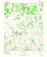 1967 Stratford1968 Print · USGSThe town of Stratford is captured in the late sixties as a rail-centered hub during the height of local energy production. Researchers can trace the Atchison Topeka and Santa Fe line, locate numerous Oil Wells, and find family history at Midland Cem.3 unique versions available
 - 1967 Map of Hart, 1968 Print
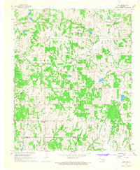 1967 Hart1968 Print · USGSGarvin County's rural landscape is captured here in the mid-1960s, showing a region shaped by winding creek systems and early oil exploration. Genealogists can locate family landmarks like Corley Cem, Hart Cem, and the Prairie View Mission near the town of Hart.2 unique versions available
 - 1969 Map of Hennepin, 1971 Print
 1969 Hennepin1971 Print · USGSSouthern Oklahoma at the end of the sixties reveals a landscape shaped by petroleum production and deep-rooted rural settlements. Researchers can locate the Fort Arbuckle Ruins and trace the boundaries of the Elmore Oil Field near Hennepin.2 unique versions available
 - 1969 Map of Elmore City NE, 1971 Print
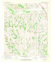 1969 Elmore City NE1971 Print · USGSGarvin County's rural landscape is captured here in the late sixties during a period of steady petroleum production. Genealogists and local historians can trace family roots at Klondike Cem or locate community centers like Love Ch and Fair Oak Ch.3 unique versions available
 - 1969 Map of Elmore City North, 1971 Print
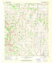 1969 Elmore City North1971 Print · USGSGarvin County was defined by its petroleum and agricultural industries in the late 1960s. Researchers can locate specific wells within the Lindsay Oil Field and trace family roots near Antioch Cem or the Elmore City waterworks.2 unique versions available
 - 1969 Map of Elmore City South, 1971 Print
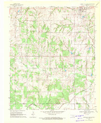 1969 Elmore City South1971 Print · USGSElmore City and the surrounding Garvin County oil fields are captured here in the late sixties at the height of regional production. Researchers can locate family landmarks like Little Flock Ch, trace the Elmore Field infrastructure, and find the now-obscured Refinery and Satterwhite settlement.
 - 1974 Map of Pernell, 1977 Print
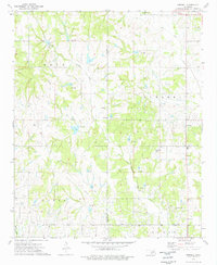 1974 Pernell1977 Print · USGSSouth-central Oklahoma's oil-rich landscapes come into focus during the mid-1970s as industrial development meets rural heritage. Researchers can trace local lineage through Pernell Sch and family landmarks like Robberson Cem and Dripping Springs Cem.
 - 1974 Map of Purdy, 1977 Print
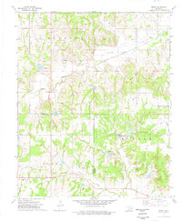 1974 Purdy1977 Print · USGSGarvin and Stephens counties are captured in the mid-1970s, showcasing the intersection of the regional petroleum industry and rural community life. Researchers can locate family landmarks such as Purdy Cem, Doyle Sch, and the Mountain View Ch.
 - 1974 Map of Cox City, 1977 Print
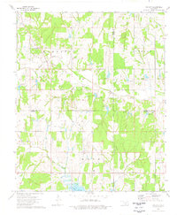 1974 Cox City1977 Print · USGSStephens and Grady counties are shown in the mid-seventies during a height of energy production. Genealogists and historians can trace family roots at Killgore Cem and Pearl Ch, or locate old drilling operations at the Cox City Oil Field.
 - 1986 Map of Pauls Valley
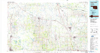 1986 Pauls Valley1986 Print · USGSGarvin County and its neighbors are shown in the mid-1980s during a period of steady growth along the Washita River. Researchers can trace the path of the Atchison Topeka and Santa Fe railroad through Pauls Valley or locate rural sites like Mt Olive Church and Erin Springs.2 unique versions available
Showing maps 1-25 of 116
Top cities of Garvin County
- Pauls Valley historical maps
- Lindsay historical maps
- Wynnewood historical maps
- Stratford historical maps
- Maysville historical maps
- Elmore City historical maps
See more
Frequently asked questions
- What are the different types of historical maps available for Garvin County?
- What is the oldest map of Garvin County?
- Where can I purchase historical maps of Garvin County for my home or office?
- Where can I download high-res historical maps of Garvin County?
- Are there historical topographic maps available for Garvin County?
- Is there historical aerial imagery available for Garvin County?
- Where are historical maps of Garvin County sourced from?