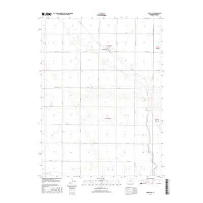
2016 Map of Hereford
USGS Topo · Published 2016About this map
The high plains of Weld County are defined here by the winding course of Crow Cr, which cuts a distinct diagonal valley across this northern Colorado landscape. The settlement of Hereford sits at a strategic junction near the creek, where the local street grid including Broadway and Circle Dr meets the expansive network of section-line roads. This 2016 survey illustrates a rural environment shaped by modern water management and the Public Land Survey System, with the Adams and Bunker Reservoir Number 3 visible in the southwest corner. The map documents the persistent agricultural grid of the region, from Co RD 138 in the north to Co RD 124 in the south, preserving the contemporary layout of this ranching and farming community.
Find a feature on this map
25 named features on this map. Tap any name to fly to it.
Don’t see what you’re looking for? This feature index may not catch every label — zoom into the map to look around manually.
Map Details
Editions of this 2016 Hereford Map
This is the sole edition of this map. No revisions or reprints were ever made.
Other maps of this area

1954 · Cheyenne
USGS Topo · 1:250,000

1954 · Greeley
USGS Topo · 1:250,000

1957 · Greeley
USGS Topo · 1:250,000

1958 · Cheyenne
USGS Topo · 1:250,000

1958 · Greeley
USGS Topo · 1:250,000

1961 · Greeley
USGS Topo · 1:250,000

1963 · Arcola
USGS Topo · 1:24,000

1963 · Carpenter
USGS Topo · 1:24,000

1963 · Pine Bluffs SW
USGS Topo · 1:24,000

1964 · Greeley
USGS Topo · 1:250,000