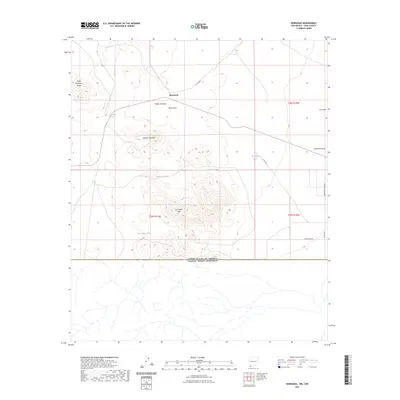
2023 Map of Hermanas
USGS Topo · Published 2023About this map
Hermanas sits at a geographic crossroads in the high desert of Luna County, just north of the United States of America Estados Unidos Mexicanos border. The landscape is defined by the volcanic prominence of the Carrizalillo Hills and Johnson Mountain, with the Cedar Mountain Range visible to the northwest. This arid environment relies on critical water sources like Carrizalillo Spring and a series of livestock tanks, including Thirtythree Tank and Number 2 Tank, which support the region's ranching heritage. The drainage patterns of Baker Draw and Hermanas Draw illustrate the natural flow of the basin toward the international line. Locally maintained routes like Carzalia Loop and Co RD c003 provide access to this isolated borderland, where the traditional township and range grid meets the stark boundary of the desert frontier.
Find a feature on this map
22 named features on this map. Tap any name to fly to it.
Don’t see what you’re looking for? This feature index may not catch every label — zoom into the map to look around manually.
Map Details
Editions of this 2023 Hermanas Map
This is the sole edition of this map. No revisions or reprints were ever made.
Other maps of this area

1917 · Hermanas
USGS Topo · 1:62,500

1918 · Hermanas
USGS Topo · 1:62,500

1918 · Victorio
USGS Topo · 1:62,500

1943 · Hermanas
USGS Topo · 1:62,500

1953 · El Paso
USGS Topo · 1:250,000

1955 · Douglas
USGS Topo · 1:250,000

1959 · Douglas
USGS Topo · 1:250,000

1959 · El Paso
USGS Topo · 1:250,000

1961 · Douglas
USGS Topo · 1:250,000

1964 · El Paso
USGS Topo · 1:250,000