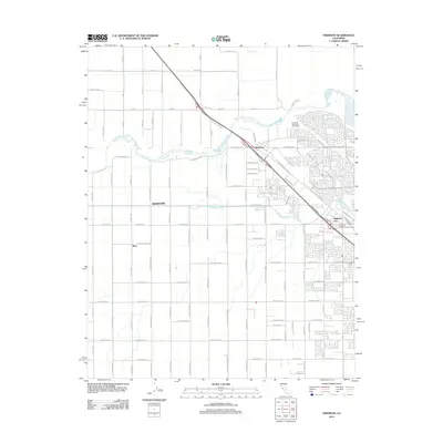
2012 Map of Herndon
USGS Topo · Published 2012About this map
San Joaquin River waters cut through the northern edge of this 2012 survey, defining the boundary where the agricultural grid of the Central Valley meets expanding residential developments. The area is anchored by the historic settlement of Herndon, situated where Golden State Blvd crosses the river. South of the river, the map details a dense network of suburban streets and established agricultural avenues, including the notable Forestiere Underground Gardens near Highway City. The landscape reflects a shift from purely rural origins, evidenced by the large-scale grid of Barstow and the presence of the Riverside Municipal Golf Course, toward the modern residential expansion seen in the southeast. Significant infrastructure like the Herndon Canal and arterial routes such as W Shaw Ave and W McKinley Ave illustrate the complex water management and transportation systems required for this productive region.
Find a feature on this map
37 named features on this map. Tap any name to fly to it.
Don’t see what you’re looking for? This feature index may not catch every label — zoom into the map to look around manually.
Map Details
Editions of this 2012 Herndon Map
This is the sole edition of this map. No revisions or reprints were ever made.
Other maps of this area

1921 · Bullard
USGS Topo · 1:31,680

1922 · Lanes Bridge
USGS Topo · 1:31,680

1922 · Gregg
USGS Topo · 1:31,680

1922 · Madera
USGS Topo · 1:31,680

1923 · Kearney Park
USGS Topo · 1:31,680

1923 · Herndon
USGS Topo · 1:31,680

1923 · Fresno
USGS Topo · 1:31,680

1923 · Biola
USGS Topo · 1:31,680

1923 · Bullard
USGS Topo · 1:31,680
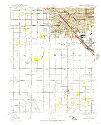
1946 · Fresno South
USGS Topo · 1:24,000