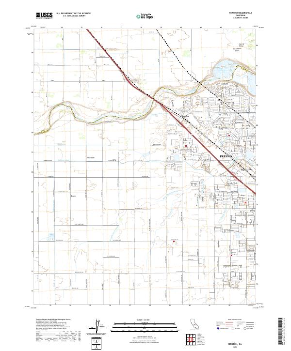
2021 Map of Herndon
USGS Topo · Published 2021About this map
The San Joaquin River forms the primary geographic boundary of this region, separating the flat agricultural expanses of the Central Valley between Madera and Fresno counties. The settlement of Herndon sits prominently along the riverbank, serving as a historic transit point where Golden State Blvd and the railroad corridors converge. This landscape is defined by an intricate network of irrigation infrastructure essential to the valley's productivity, featuring the Epstein Canal, Herndon Canal, and several named watercourses like Silvia Ditch and Humphrey Ditch. To the southeast, the residential expansion of Fresno begins to meet smaller rural nodes such as Highway City, while more isolated outposts like Barstow and Raco remain surrounded by the gridded field patterns of the western valley.
Find a feature on this map
87 named features on this map. Tap any name to fly to it.
Don’t see what you’re looking for? This feature index may not catch every label — zoom into the map to look around manually.
Map Details
Editions of this 2021 Herndon Map
This is the sole edition of this map. No revisions or reprints were ever made.
Other maps of this area

1921 · Bullard
USGS Topo · 1:31,680

1922 · Lanes Bridge
USGS Topo · 1:31,680

1922 · Gregg
USGS Topo · 1:31,680

1922 · Madera
USGS Topo · 1:31,680

1923 · Kearney Park
USGS Topo · 1:31,680

1923 · Herndon
USGS Topo · 1:31,680

1923 · Fresno
USGS Topo · 1:31,680

1923 · Biola
USGS Topo · 1:31,680

1923 · Bullard
USGS Topo · 1:31,680
1946 · Fresno South
USGS Topo · 1:24,000